Sangre Grande (Sangre Grande)
The name Sangre Grande means "big blood", and it has been suggested that the town was named for a battle that took place between the native Amerindians and the Spanish settlers. However, this interpretation is not supported by historical records. The true origin of the name refers to when, in the late 1770s, Spanish surveyors who were charting the island for the purposes of creating a map, found that the waters of two of the tributaries of the nearby Oropouche River were red as blood, hence the name.
Similarly, the neighbouring town is called Sangre Chiquito ("small blood") is named for the presence of a smaller, similarly colored river in that town. Sangre Grande grew as a result of the growth of cacao cultivation in the late nineteenth century. It grew further when it became the terminus of the railroad. Construction of the railroad caused the town to migrate down the hill to meet the railroad. When the town relocated to the foot of the hill, the name Sangre Grande moved with it. As a result, the name of the pre-existing village, Cunapo, was largely, but not entirely, lost.
Map - Sangre Grande (Sangre Grande)
Map
Country - Trinidad_and_Tobago
 |
 |
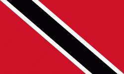
| Flag of Trinidad and Tobago | |
The island of Trinidad was inhabited for centuries by Indigenous peoples before becoming a colony in the Spanish Empire, following the arrival of Christopher Columbus, in 1498. Spanish governor José María Chacón surrendered the island to a British fleet under the command of Sir Ralph Abercromby in 1797. Trinidad and Tobago were ceded to Britain in 1802 under the Treaty of Amiens as separate states and unified in 1889. Trinidad and Tobago obtained independence in 1962, becoming a republic in 1976.
Currency / Language
| ISO | Currency | Symbol | Significant figures |
|---|---|---|---|
| TTD | Trinidad and Tobago dollar | $ | 2 |
| ISO | Language |
|---|---|
| ZH | Chinese language |
| EN | English language |
| FR | French language |
| ES | Spanish language |


