Soroca (Raionul Soroca)
 |
 |
The city has its origin in the medieval Genoese trade post of Olchionia, or Alchona. It is known for its well-preserved stronghold, established by the Moldavian prince Stephen the Great (Ștefan cel Mare in Romanian) in 1499. The origins of the name Soroca are not fully known. Soroca (Russian: сорока) means Magpie in Russian. Its location is only a few kilometers from the Moldova–Ukrainian border.
The original wooden fort, which defended a ford over the Dniester, was an important link in the chain of fortifications which comprised four forts (e.g., Bilhorod-Dnistrovskyi, then known as Akkerman, and Khotyn) on the Dniester, two forts on the Danube, and three forts on the north border of medieval Moldavia. Between 1543 and 1546, under the rule of Peter IV Rareș, the fort was rebuilt in stone as a perfect circle with five bastions situated at equal distances.
During the Great Turkish War, John III Sobieski's forces successfully defended the fort against the Ottomans. It was of vital military importance during the Pruth River Campaign of Peter the Great in 1711. The stronghold was sacked by the Russians in the Austro-Russian–Turkish War (1735–39). The Soroca Fort is an important attraction in Soroca, having preserved cultures and kept the old Soroca to the present day.
The locality was greatly extended in the 19th century, during a period of relative prosperity. Soroca became a regional center featuring large squares, modernized streets, hospitals, grammar schools and conventionalized churches. During the Soviet period, the city became an important industrial center for northern Moldova.
Soroca was known for producing grapes, wheat, maize, and tobacco in 1919.
Map - Soroca (Raionul Soroca)
Map


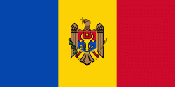
Country - Moldova
 |
 |
| Flag of Moldova | |
Most of Moldovan territory was a part of the Principality of Moldavia from the 14th century until 1812, when it was ceded to the Russian Empire by the Ottoman Empire (to which Moldavia was a vassal state) and became known as Bessarabia. In 1856, southern Bessarabia was returned to Moldavia, which three years later united with Wallachia to form Romania, but Russian rule was restored over the whole of the region in 1878. During the 1917 Russian Revolution, Bessarabia briefly became an autonomous state within the Russian Republic. In February 1918, it declared independence and then integrated into Romania later that year following a vote of its assembly. The decision was disputed by Soviet Russia, which in 1924 established, within the Ukrainian SSR, a so-called Moldavian autonomous republic on partially Moldovan-inhabited territories to the east of Bessarabia.
Currency / Language
| ISO | Currency | Symbol | Significant figures |
|---|---|---|---|
| MDL | Moldovan leu | L | 2 |
| ISO | Language |
|---|---|
| RO | Romanian language |
| RU | Russian language |
| TR | Turkish language |