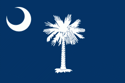
South Carolina (South Carolina)
 |
 |
South Carolina was named in honor of King Charles I of England, who first formed the English colony, with Carolus being Latin for "Charles". In 1712 the Province of South Carolina was formed. One of the original Thirteen Colonies, South Carolina became a royal colony in 1719. During the American Revolutionary War, South Carolina was the site of major activity among the American colonies, with more than 200 battles and skirmishes fought within the state. South Carolina became the eighth state to ratify the U.S. Constitution on May 23, 1788. A slave state, it was the first state to vote in favor of secession from the Union on December 20, 1860. After the American Civil War, it was readmitted into the United States on July 9, 1868.
During the early-to-mid 20th century, the state started to see economic progress as many textile mills and factories were built across the state. The civil rights movement of the mid-20th century helped in ending segregation and legal discrimination policies within the state. Economic diversification in South Carolina continued to pick up speed during and in the ensuing decades after World War II. In the early 21st century, South Carolina's economy is based on industries such as aerospace, agribusiness, automotive manufacturing, and tourism.
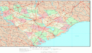
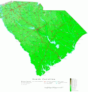
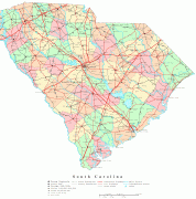
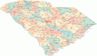
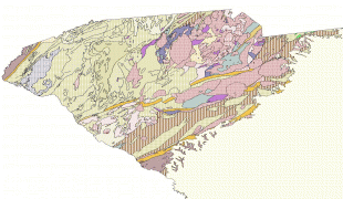
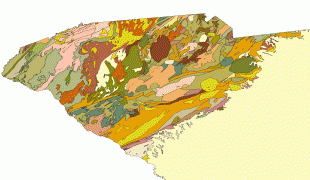
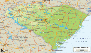
Within South Carolina from east to west are three main geographic regions, the Atlantic coastal plain, the Piedmont, and the Blue Ridge Mountains in the northwestern corner of Upstate South Carolina. South Carolina has primarily a humid subtropical climate, with hot humid summers and mild winters. Areas in the Upstate have a subtropical highland climate. Along South Carolina's eastern coastal plain are many salt marshes and estuaries. South Carolina's southeastern Lowcountry contains portions of the Sea Islands, a chain of barrier islands along the Atlantic Ocean.
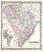
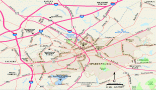
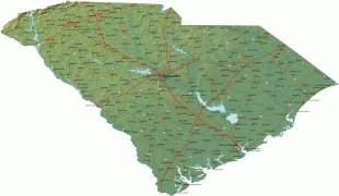
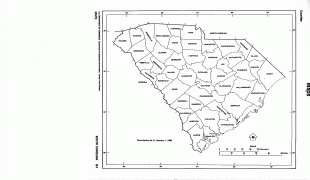
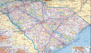
Map - South Carolina (South Carolina)
Map


Country - United_States
 |
 |
| Flag of the United States | |
Indigenous peoples have inhabited the Americas for thousands of years. Beginning in 1607, British colonization led to the establishment of the Thirteen Colonies in what is now the Eastern United States. They quarreled with the British Crown over taxation and political representation, leading to the American Revolution and proceeding Revolutionary War. The United States declared independence on July 4, 1776, becoming the first nation-state founded on Enlightenment principles of unalienable natural rights, consent of the governed, and liberal democracy. The country began expanding across North America, spanning the continent by 1848. Sectional division surrounding slavery in the Southern United States led to the secession of the Confederate States of America, which fought the remaining states of the Union during the American Civil War (1861–1865). With the Union's victory and preservation, slavery was abolished nationally by the Thirteenth Amendment.
Currency / Language
| ISO | Currency | Symbol | Significant figures |
|---|---|---|---|
| USD | United States dollar | $ | 2 |
| ISO | Language |
|---|---|
| EN | English language |
| FR | French language |
| ES | Spanish language |


