South Kazakhstan Province (Turkistan)
 |
The Region was created as South Kazakhstan Oblast in Kazakh SSR of Soviet Union. Between 1962 and 1992 it was named Chimkent Oblast. The administrative center of the Region was Shymkent. On 19 June 2018 Shymkent was taken out of the Region and subordinated directly to the government of Kazakhstan, the administrative center moved to Turkistan, and the Region renamed Turkistan Region.
As of 2013, the region was administratively divided into eleven districts and the cities of Shymkent, Arys, Kentau, and Turkistan.
* 1) Baydibek District, with the administrative center in the selo of Shayan;
* 2) Kazygurt District, the selo of Kazygurt;
* 3) Maktaaral District, the town of Zhetisay;
* 4) Ordabasy District, the selo of Temirlan;
* 5) Otyrar District, the selo of Shauldir;
* 6) Saryagash District, the town of Saryagash;
* 7) Sayram District, the selo of Aksukent;
Map - South Kazakhstan Province (Turkistan)
Map
Country - Kazakhstan
 |
 |
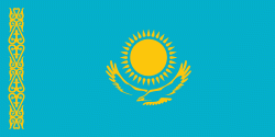
| Flag of Kazakhstan | |
The country dominates Central Asia economically and politically, generating 60 percent of the region's GDP, primarily through its oil and gas industry; it also has vast mineral resources. Officially, it is a democratic, secular, unitary, constitutional republic with a diverse cultural heritage, and has the highest Human Development Index ranking in the region. Kazakhstan is a member state of the United Nations, World Trade Organization, Commonwealth of Independent States, Shanghai Cooperation Organisation, Eurasian Economic Union, Collective Security Treaty Organization, Organization for Security and Cooperation in Europe, Organization of Islamic Cooperation, Organization of Turkic States, and International Organization of Turkic Culture.
Currency / Language
| ISO | Currency | Symbol | Significant figures |
|---|---|---|---|
| KZT | Kazakhstani tenge | ₸ | 2 |
| ISO | Language |
|---|---|
| KK | Kazakh language |
| RU | Russian language |


