South Kivu (South Kivu Province)
South Kivu Province was created from Sud-Kivu District in 1989, when the existing Kivu Province was divided into three parts (South Kivu, North Kivu and Maniema).
In June 2014, around 35 people were killed in an attack in the South Kivu village of Mutarule. The attack was apparently part of dispute over cattle.
On 7 August 2015 the 2015 South Kivu earthquake, a magnitude 5.8 earthquake, struck 35 km north-northeast of Kabare at a depth of 12.0 km. One policeman was killed.
Map - South Kivu (South Kivu Province)
Map


Country - Democratic_Republic_of_the_Congo
 |
 |
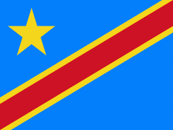
| Flag of the Democratic Republic of the Congo | |
Centered on the Congo Basin, the territory of the DRC was first inhabited by Central African foragers around 90,000 years ago and was reached by the Bantu expansion about 3,000 years ago. In the west, the Kingdom of Kongo ruled around the mouth of the Congo River from the 14th to 19th centuries. In the northeast, center and east, the kingdoms of Azande, Luba, and Lunda ruled from the 16th and 17th centuries to the 19th century. King Leopold II of Belgium formally acquired rights to the Congo territory in 1885 and declared the land his private property, naming it the Congo Free State. From 1885 to 1908, his colonial military forced the local population to produce rubber and committed widespread atrocities. In 1908, Leopold ceded the territory, which thus became a Belgian colony.
Currency / Language
| ISO | Currency | Symbol | Significant figures |
|---|---|---|---|
| CDF | Congolese franc | Fr | 2 |
| ISO | Language |
|---|---|
| FR | French language |
| KG | Kongo language |
| LN | Lingala language |