Stavyshche
 |
At the end of the 16th century on the territory that belonged to the Bila Tserkva starosta S.Lubomirski appeared a small settlement that was named as Lubomir. However, after several raids by Crimean Tatars it was razed. Only separate dwellings have survived among the local ponds. Note, the word stav in both Polish and Ukrainian languages means a pond, while suffix -shche (-shcha) means a geographic area, land. At the beginning of the 17th century the village of Stavyshche is mentioned in a list of the Ruzinski's domain. It is the first recorded mentioning of its existence. In 1622 it is already mentioned as one of villages of magnate Chodkiewicz in Kiev Voivodeship and was relieved of all taxes due its impoverishment by suffering from raids by Crimean Tatars and permanent stationing in the area of the Polish Royal troops. In 1635 Stavyshche was mentioned already as a town that had defensive fortifications and military garrison. It was granted the rights of Magdeburg law, according to which the local craftsmen were joining in crafts shops.
The town joined the Khmelnytsky Uprising of 1648-54. Just before the uprising one of Khmelnytskyi's envoys Yarema Konchevskyi who arrived to the town was reassured by its residents that the city's guns will not cause harm to the insurgents. It became a company (hundred) center of Bila Tserkva Regiment. In 1655 Bohdan Khmelnytsky engaged the Polish-Tatars army in battle at Stavyshche.
A decade later the town was the center of the Varenytsia Uprising. Its inhabitants did not accept the town’s return to Polish rule (1667) and rebelled repeatedly in the course of the next century (1702—04, 1730s, 1750s). With the partition of Poland in 1793, Stavyshche was annexed by Russia, and became part of Tarashcha county in the Kiev Governorate.
In the 19th century it acquired a distillery, flour mill, and brick factory. By 1900 its population had reached 8,500. Today the town has a construction company and a food industry.
Until 18 July 2020, Stavyshche was the administrative center of Stavyshche Raion. The raion was abolished that day as part of the administrative reform of Ukraine, which reduced the number of raions of Kyiv Oblast to seven. The area of Stavyshche Raion was merged into Bila Tserkva Raion.
Map - Stavyshche
Map


Country - Ukraine
 |
 |
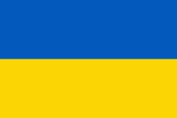
| Flag of Ukraine | |
During the Middle Ages, Ukraine was the site of early Slavic expansion and the area later became a key centre of East Slavic culture under the state of Kievan Rus', which emerged in the 9th century. The state eventually disintegrated into rival regional powers and was ultimately destroyed by the Mongol invasions of the 13th century. The area was then contested, divided, and ruled by a variety of external powers for the next 600 years, including the Polish–Lithuanian Commonwealth, the Austrian Empire, the Ottoman Empire, and the Tsardom of Russia. The Cossack Hetmanate emerged in central Ukraine in the 17th century, but was partitioned between Russia and Poland, and ultimately absorbed by the Russian Empire. Ukrainian nationalism developed, and following the Russian Revolution in 1917, the short-lived Ukrainian People's Republic was formed. The Bolsheviks consolidated control over much of the former empire and established the Ukrainian Soviet Socialist Republic, which became a constituent republic of the Soviet Union when it was formed in 1922. In the early 1930s, millions of Ukrainians died in the Holodomor, a man-made famine. During World War II, Ukraine was devastated by the German occupation.
Currency / Language
| ISO | Currency | Symbol | Significant figures |
|---|---|---|---|
| UAH | Ukrainian hryvnia | â‚´ | 2 |
| ISO | Language |
|---|---|
| HU | Hungarian language |
| PL | Polish language |
| RU | Russian language |
| UK | Ukrainian language |