Stykkishólmur (Stykkishólmsbær)
Stykkishólmur is a town and municipality situated in the western part of Iceland, in the northern part of the Snæfellsnes peninsula. It is a center of services and commerce for the area. Most of the people make their living from fishing and tourism. A ferry called Baldur goes over the Breiðafjörður fjord to the Westfjords. It also is the gateway to Flatey. The origin of Stykkishólmur can be traced to its natural harbor. The location became an important trading post early in Iceland's history: the first trading post in Stykkishólmur is traced back to the mid-16th century, even before Denmark implemented the Danish–Icelandic Trade Monopoly (1602 – 1787). From that time trading has been at the heart of the settlement's history. In 1828 Árni Thorlacius built a large house for his home and companies, the Norwegian house, which has been renovated and accommodates the local museum.
The favorable position of the town was discovered early and in 1550 a trading post was founded at the site. Today, the most important sector of employment in the town after the fishing industry is summer-time tourism. There are several sightworthy wooden buildings in the town centre. Egilsenshús is a wooden house dating from 1867 which belonged to a Danish merchant.
The town was named after a small island in front of the harbor called Stykkið (, "the piece"). The nearby mountain of Helgafell is the burial place of Guðrún Ósvífursdóttir, a heroine of the Icelandic sagas.
The town's former library has been restored as a public hall and contains an installation by the American artist Roni Horn.
The sports club of Stykkishólmur is called Snæfell, named after the glacier Snæfellsjökull, which is located on Snæfellsnes. The town's most popular sport is basketball.
Map - Stykkishólmur (Stykkishólmsbær)
Map
Country - Iceland
 |
 |
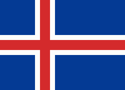
| Flag of Iceland | |
According to the ancient manuscript Landnámabók, the settlement of Iceland began in 874 AD when the Norwegian chieftain Ingólfr Arnarson became the first permanent settler on the island. In the following centuries, Norwegians, and to a lesser extent other Scandinavians, immigrated to Iceland, bringing with them thralls (i.e., slaves or serfs) of Gaelic origin.
Currency / Language
| ISO | Currency | Symbol | Significant figures |
|---|---|---|---|
| ISK | Icelandic króna | kr | 0 |
| ISO | Language |
|---|---|
| DA | Danish language |
| EN | English language |
| DE | German language |
| IS | Icelandic language |
| NO | Norwegian language |
| SV | Swedish language |


