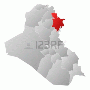
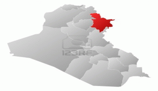
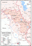
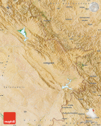
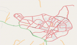
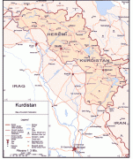
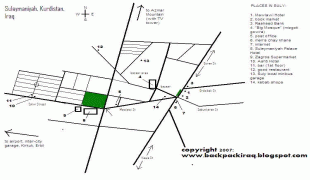
Sulaymaniyah (As Sulaymānīyah)
Sulaymaniyah, also spelled as Slemani (سلێمانی, السليمانية ), is a city in the east of the Kurdistan Region of Iraq, not far from the Iran–Iraq border. It is surrounded by the Azmar, Goizha and Qaiwan Mountains in the northeast, Baranan Mountain in the south and the Tasluja Hills in the west. The city has a semi-arid climate with very hot dry summers and cold wet winters.
From its foundation Sulaymaniyah was always a center of great poets, writers, historians, politicians, scholars and singers, such as Nalî, Mahwi, and Piramerd. The modern city of Sulaymaniyah was founded in 1784 by the Ottoman-Kurdish prince Ibrahim Pasha Baban, who named it after his father Sulaiman Pasha. Sulaymaniyah was the capital of the historic principality of Baban from 1784 to 1850.
The region of Sulaymaniyah was known as Zamwa prior to the foundation of the modern city in 1784. The capital of the Kurdish Baban principality (1649–1850), before Sulaymaniyah, was a territory named "Qelaçiwalan". At the time of the Babani's rule there were major conflicts between the Safavid dynasty and the Ottoman Empire. Qelaçiwalan became a battleground for the two rivals.
Being of strategic importance and lying deep inside Safavid territory, there was concern that Qelaçiwalan would be attacked and captured if the Babani did not give the Safavids military support, as both Sultan Mahmud II and Nader Shah were trying to gain the support of the dispersed Kurdish Emirates. This obliged Mahmud Pasha of Baban in 1781 to think about moving the center of the emirate to a safer place. He chose Melkendî, then a village but now a district in central Sulaymaniyah, to construct a number of for his political and armed units.
In 1783, Ibrahim Pasha Baban became ruler of the emirate and began the reconstruction of a city which once constructed by Ottoman Sultan Sulaiman (the name of Sulaimaniyah came from his name) new city which would become its capital. In 1784 he finished erecting a number of palaces for trade called Qeyserîs and bazaars, which were also used as baths, and began inviting people from the surrounding villages and emirates to move to the newly established city. Soon Melkendî, which was originally intended to be the city itself, instead became one of its quarters. The new city of Sulaymaniyah was named after Sulaiman Baba, who was the first Baban prince to gain control of the province of Şarezûr. Sulaiman Baba invaded the neighboring Kurdish vassaldom of Ardalan, defeating their forces in 1694. Ottoman Sultan Mustafa II assigned him the district of Baban.
In the early 1800s refugees from Ardalan moved to Sulaymaniyah, including Mastura Ardalan, the widow of Xosraw Xanî Erdalan, the ruler of the kingdom. Erdalan wrote an account of Kurdish history in Persian and was buried in Sulaymaniyah when he died in 1848.
From 1922 to 1924, Sulaymaniyah was the capital of the Kingdom of Kurdistan, a short-lived unrecognized state declared by Iraqi Kurds following the collapse of the Ottoman Empire.
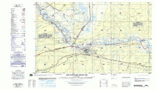
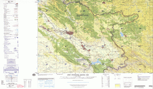
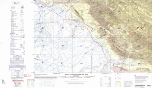
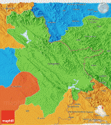
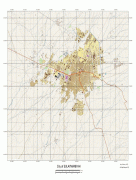
Map - Sulaymaniyah (As Sulaymānīyah)
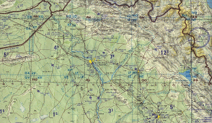
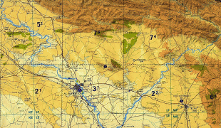
Map


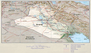
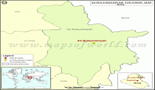
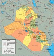
Country - Mesopotamia
 |
|
| Flag of Iraq | |
The Sumerians and Akkadians (including Assyrians and Babylonians) originating from different areas in present-day Iraq, dominated Mesopotamia from the beginning of written history (c. 3100 BC) to the fall of Babylon in 539 BC, when it was conquered by the Achaemenid Empire. It fell to Alexander the Great in 332 BC, and after his death, it became part of the Greek Seleucid Empire. Later the Arameans dominated major parts of Mesopotamia (c. 900 BC – 270 AD).
Currency / Language
| ISO | Currency | Symbol | Significant figures |
|---|---|---|---|
| IQD | Iraqi dinar | عد | 3 |
| ISO | Language |
|---|---|
| AR | Arabic language |
| HY | Armenian language |
| KU | Kurdish language |