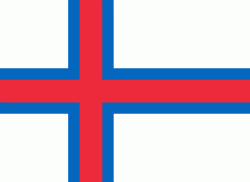
Suðuroy (Suðuroyar sýsla)
Suðuroy (literally South Island, Suderø) is the southernmost of the Faroe Islands. The island covers 163.7 square kilometres (63.2 sq mi). In 2018 the population was 4,601. Suðuroy region (sýsla) comprises this island and Lítla Dímun, the next isle northward in the Faroes, which is uninhabited.
One ancient settlement, Víkarbyrgi was abandoned late in the 1990s. Another settlement, Akraberg was abandoned around 1350 because of the Black Death; the people who lived there at that time came from Friesland, and legend has it that people in Hørg (in Sumba) can trace their ancestry back to this settlement, which was situated on the southernmost point of the island.
In the 17th century, Suðuroy was subjected to repeated attacks by North African pirates, who in the Faroe Islands were referred to as Turks when North Africa belonged to the Ottoman Empire. One well known such incident was the Slave raid of Suðuroy .They abducted several women and children. Famine ensued, and many of the island's inhabitants died of starvation. In 1615, the pirate-plagued Hvalba was rescued by two Danish warships in the spring. The pirates, who used Hvalba as a kind of base port, had unfortunately sailed 14 days before the arrival of the Danish squadron.
The village of Sandvík was re-established in the 19th century. Fámara was re-settled in 2010 with the expansion of Vágur beyond its original town borders. Two more settlements were started in the early and mid-20th century: Botni, northwest of Vágur, and Tjaldavík, in a bay southeast of Øravík. Both sites have been abandoned again.
Suðuroy's population has been falling gradually since the 1970s. In 1985, the island had 5,881 inhabitants, but by 2019 the population fell to a record low of 4,591.
Map - Suðuroy (Suðuroyar sýsla)
Map
Country - Faroe_Island
 |
 |
They are located 200 mi north-northwest of the United Kingdom, and about halfway between Norway (360 mi away) and Iceland (270 mi away). The islands form part of the Kingdom of Denmark, along with mainland Denmark and Greenland. The islands have a total area of about 540 sqmi with a population of 54,000 as of June 2022.
Currency / Language
| ISO | Currency | Symbol | Significant figures |
|---|---|---|---|
| DKK | Danish krone | kr | 2 |
| ISO | Language |
|---|---|
| DA | Danish language |
| FO | Faroese language |


