Swat District (Swāt District)
Swat District (, سوات ولسوالۍ, ) is a district in the Malakand Division of Khyber Pakhtunkhwa, Pakistan. With a population of 2,309,570 per the 2017 national census, Swat is the 15th-largest district of Khyber Pakhtunkhwa province.
Swat District is centered on the Valley of Swat, usually referred to simply as Swat, which is a natural geographic region surrounding the Swat River. The valley was a major centre of early Buddhism under the ancient kingdom of Gandhara, and was a major centre of Gandharan Buddhism, with pockets of Buddhism persisting in the valley until the 10th century, after which the area became largely Muslim. Until 1969, Swat was part of the Yusafzai State of Swat, a self-governing princely state that was inherited by Pakistan following its independence from British rule. The region was seized by the Tehrik-i-Taliban in late-2007 until Pakistani control was re-established in mid-2009.
The average elevation of Swat is 980 m, resulting in a considerably cooler and wetter climate compared to the rest of Pakistan. With lush forests, verdant alpine meadows, and snow-capped mountains, Swat is one of the country's most popular tourist destinations.
The name "Swat" is derived from the Swat River. The Swat River referred to as the Suvāstu in the Rig Veda, with a literal meaning "of fair dwellings". Some have suggested the Sanskrit name may mean "clear blue water." Another theory derives the word Swat from the Sanskrit word shveta, also used to describe the clear water of the Swat River. To the ancient Greeks, the river was known as the Soastus. The Chinese pilgrim Faxian referred to Swat as the Su-ho-to.
Map - Swat District (Swāt District)
Map
Country - Pakistan
 |
 |
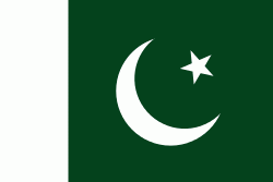
| Flag of Pakistan | |
Pakistan is the site of several ancient cultures, including the 8,500-year-old Neolithic site of Mehrgarh in Balochistan, the Indus Valley civilisation of the Bronze Age, the most extensive of the civilisations of the Afro-Eurasia, and the ancient Gandhara civilization. The region that comprises the modern state of Pakistan was the realm of multiple empires and dynasties, including the Achaemenid; briefly that of Alexander the Great; the Seleucid, the Maurya, the Kushan, the Gupta; the Umayyad Caliphate in its southern regions, the Hindu Shahis, the Ghaznavids, the Delhi Sultanate, the Mughals, the Durranis, the Omani Empire, the Sikh Empire, British East India Company rule, and most recently, the British Indian Empire from 1858 to 1947.
Currency / Language
| ISO | Currency | Symbol | Significant figures |
|---|---|---|---|
| PKR | Pakistani rupee | ₨ | 2 |
| ISO | Language |
|---|---|
| EN | English language |
| PA | Panjabi language |
| PS | Pashto language |
| SD | Sindhi language |
| UR | Urdu |


