Taiping (Taiping)
 |
Taiping took over Kuala Kangsar's role as the state capital from 1876 to 1937, but was then replaced by Ipoh. Its growth slowed after that, but in recent years the town has been developing rapidly again. Perak State Museum is located in the town.
Taiping also receives some limelight for being the wettest town in Peninsular Malaysia. The average annual rainfall is about 4,000mm in Taiping while the peninsula's average is 2,000mm – 2,500mm. Its unusual rainfall has also led to a fertile collection of flora and century-old rain trees in the Taiping Lake Gardens.
Taiping was ranked Top 3 Sustainable Cities in the world.
The area developed quickly in the 19th century when tin was discovered. The mines attracted large numbers of settlers, particularly Chinese. Feuds began between the different groups of Chinese immigrants and became so bitter that in the early 1870s, the British intervened and assumed control of the town. Taiping was the capital for the districts of Larut, Matang and Selama in Perak. Before 1937, Taiping was the capital of the state of Perak and the centre of a long and drawn out war resulting in a change of rulership for the state. Taiping used to be known as Klian Pauh – Klian meaning mine while Pauh is a type of small mango.
Long Jaafar has been historically credited with the discovery of tin in Larut in 1848. According to legend, Long Jaafar had an elephant named Larut and he used to take this elephant with him when journeying between Bukit Gantang and Lubok Merbau. One day the elephant went missing and when the elephant was eventually found three days later Long Jaafar noticed tin ore embedded in the mud that was on the elephant's legs. It is said that this was how Larut got its name.
Eventually in 1850, Larut district was bestowed upon Long Jaafar by Raja Muda Ngah Ali and the Chiefs of Perak: the Temenggong, Panglima Bukit Gantang, Panglima Kinta, Syahbandar and Seri Adika Raja. Some time later, the Sultan of Perak, Sultan Abdullah, died in 1857 and a series of succession disputes ensued. Unhappy with the abuse and favouritism of various royalties, rival Malay camps took sides with one or the other of the two great Chinese secret societies present in there at the time.
Long Jaafar established and developed his administrative centre at Bukit Gantang and made Kuala Sungai Limau at Trong the principal harbour of the Larut Settlement. In 1857 Long Jaafar was succeeded by his son Ngah Ibrahim. Sultan Jaffar Muazzam Shah presented an acknowledgement letter to Ngah Ibrahim on 24 May 1858. This letter was signed by Sultan Jaffar, Raja Muda Ngah Ali and the Raja Bendahara of Perak. In the time of Ngah Ibrahim the Chinese increased in number and by early 1860 two large groups were formed by the Chinese, the "Five Associations" whose members worked in the mines of Klian Pauh and the "Four Associations" whose members worked in the mines of Klian Baharu.
Mining rights were given to the Hakka "Five Associations" or Go-Kuan (五館 or 五群) and the Cantonese "Four Associations" or Si-Kuan (四館). Chung Keng Quee (鄭景貴) was leader of the Hakka Go-Kuan and the Hai San (海山) society that they belonged to, and began to operate his tin mines in Larut in 1860. Larut was destined to be plagued by four major wars between members of both the Cantonese Go-Kuan Ghee Hin Society (義興私會黨) and the Hakka Hai San society. Many Hakka had fled China when the Taiping Rebellion broke out there and found work in the mines of Chung Keng Quee establishing his position over the mining area in Larut as leader of the Hai San from 1860 to 1884.
The capital of Perak was moved from Bandar Baru (New Town) to Taiping after Datok Maharaja Lela assassinated the first British Resident of Perak Mr. James Wheeler Woodford Birch at Pasir Salak in 1875. In 1937, the capital of Perak was moved from Taiping to Ipoh.
Map - Taiping (Taiping)
Map
Country - Malaysia
 |
 |
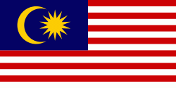
| Flag of Malaysia | |
Malaysia has its origins in the Malay kingdoms, which, from the 18th century on, became subject to the British Empire, along with the British Straits Settlements protectorate. Peninsular Malaysia was unified as the Malayan Union in 1946. Malaya was restructured as the Federation of Malaya in 1948 and achieved independence on 31 August 1957. The independent Malaya united with the then British crown colonies of North Borneo, Sarawak, and Singapore on 16 September 1963 to become Malaysia. In August 1965, Singapore was expelled from the federation and became a separate independent country.
Currency / Language
| ISO | Currency | Symbol | Significant figures |
|---|---|---|---|
| MYR | Malaysian ringgit | RM | 2 |
| ISO | Language |
|---|---|
| ZH | Chinese language |
| EN | English language |
| MS | Malay language |
| ML | Malayalam language |
| PA | Panjabi language |
| TA | Tamil language |
| TE | Telugu language |
| TH | Thai language |


