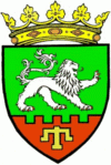
Taraclia District (Taraclia)
 |
As of 1 January 2012, its population was 44,100, 65.6% of whom were ethnic Bulgarians. The district covers an area of 674 km2 and has the lowest population density of all districts of Moldova.
The district was formed on November 11, 1940, with its center in the village of Taraclia, in the Moldavian SSR. Until October 16, 1949 it was part of the Cahul uyezd, after the abolition of the uyezd it passed to direct republican subordination.
Between January 31, 1952 and June 15, 1953 the area was part of Cahul county, after the abolition of the county division it returned to direct republican subordination.
On January 9, 1956 the territory of Taraclia district was almost doubled due to the annexation of parts of the territory of the abolished Kangazi district.
On December 25, 1962 a new division of the territory of the Republic was established. The Taraclia region was abolished and its territory was divided between the neighboring regions of Kagul, Komrat and Chadarlung.
On November 10, 1980, the district was restored with almost the same boundaries as in 1956, adding part of the territories of Vulkanesti and Chadarlung districts.
In the mid-1990s, after the creation of the autonomous territorial entity of Gagauzia, there was a mutual transfer of villages between Gagauzia and the Taraclia region. As a result of the transfer, the region was territorially divided into two unrelated parts.
In 1999, as part of the ongoing administrative reform, the region became part of the Kagul uyezd, but on October 22, 1999, at the request of the majority of ethnic Bulgarians in the region, a separate Taraclia uyezd was created.
The Taraclia rajon has existed since 2003. Until February 2003, the area belonged to the now dissolved Cahul District (Județul Cahul) together with today's Rajon Cahul and Cantemir. As the center of the Bulgarian minority in Moldova, which accounts for about 66% of the population, today there are numerous Bulgarian cultural institutions and schools in Taraclia District. The Bulgarian language is also one of the languages of instruction at the Taraclia State University.
Map - Taraclia District (Taraclia)
Map


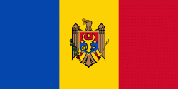
Country - Moldova
 |
 |
| Flag of Moldova | |
Most of Moldovan territory was a part of the Principality of Moldavia from the 14th century until 1812, when it was ceded to the Russian Empire by the Ottoman Empire (to which Moldavia was a vassal state) and became known as Bessarabia. In 1856, southern Bessarabia was returned to Moldavia, which three years later united with Wallachia to form Romania, but Russian rule was restored over the whole of the region in 1878. During the 1917 Russian Revolution, Bessarabia briefly became an autonomous state within the Russian Republic. In February 1918, it declared independence and then integrated into Romania later that year following a vote of its assembly. The decision was disputed by Soviet Russia, which in 1924 established, within the Ukrainian SSR, a so-called Moldavian autonomous republic on partially Moldovan-inhabited territories to the east of Bessarabia.
Currency / Language
| ISO | Currency | Symbol | Significant figures |
|---|---|---|---|
| MDL | Moldovan leu | L | 2 |
| ISO | Language |
|---|---|
| RO | Romanian language |
| RU | Russian language |
| TR | Turkish language |
