Tavastia Proper (Kanta-Häme)
 |
Hämeenlinna is the largest urban area in the region. There are two other municipalities that have township status: Riihimäki and Forssa.
The region of Kanta-Häme has been inhabited since the Stone Age. The first written mention of the historical Tavastia province is found in the Chronicle Of Novgorod, in reference to a military campaign launched by Prince Vladimir in 1042. The region had been ruled by the Swedes since the late 13th century, when Birger Jarl led the Second Crusade against the inhabitants of historical Tavastia province. In the 14th century, Häme became a fiefdom, whose administrative seat was Häme Castle. When Finland was taken from Sweden by the Russians in 1809, Tavastia proper also became part of the Russian Empire. Russian rule ended in 1917.
For more history, geography and culture see: Tavastia (historical province)
Map - Tavastia Proper (Kanta-Häme)
Map


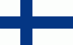
Country - Finland
 |
 |
| Flag of Finland | |
Finland was first inhabited around 9000 BC after the Last Glacial Period. The Stone Age introduced several different ceramic styles and cultures. The Bronze Age and Iron Age were characterized by contacts with other cultures in Fennoscandia and the Baltic region. From the late 13th century, Finland became a part of Sweden as a consequence of the Northern Crusades. In 1809, as a result of the Finnish War, Finland became part of the Russian Empire as the autonomous Grand Duchy of Finland, during which Finnish art flourished and the idea of independence began to take hold. In 1906, Finland became the first European state to grant universal suffrage, and the first in the world to give all adult citizens the right to run for public office. After the 1917 Russian Revolution, Finland declared independence from Russia. In 1918, the fledgling state was divided by the Finnish Civil War. During World War II, Finland fought the Soviet Union in the Winter War and the Continuation War, and Nazi Germany in the Lapland War. It subsequently lost parts of its territory, but maintained its independence.
Currency / Language
| ISO | Currency | Symbol | Significant figures |
|---|---|---|---|
| EUR | Euro | € | 2 |
| ISO | Language |
|---|---|
| FI | Finnish language |
| SV | Swedish language |