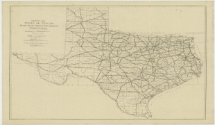
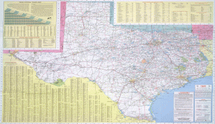
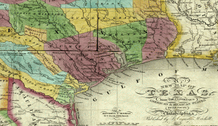
Texas
 |
 |
Houston is the most populous city in Texas and the fourth-largest in the U.S., while San Antonio is the second most populous in the state and seventh-largest in the U.S. Dallas–Fort Worth and Greater Houston are, respectively, the fourth- and fifth-largest metropolitan statistical areas in the country. Other major cities include Austin, the second most populous state capital in the U.S., and El Paso. Texas is nicknamed the Lone Star State for its former status as an independent republic, and as a reminder of the state's struggle for independence from Mexico. The Lone Star can be found on the Texas state flag and on the Texas state seal. The origin of Texas's name is from the Caddo word táyshaʼ meaning 'friends'.
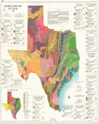
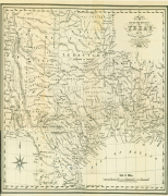
Due to its size and geologic features such as the Balcones Fault, Texas contains diverse landscapes common to both the U.S. Southern and the Southwestern regions. Although Texas is popularly associated with the U.S. southwestern deserts, less than ten percent of Texas's land area is desert. Most of the population centers are in areas of former prairies, grasslands, forests, and the coastline. Traveling from east to west, one can observe terrain that ranges from coastal swamps and piney woods, to rolling plains and rugged hills, and finally the desert and mountains of the Big Bend.
The term "six flags over Texas" refers to several nations that have ruled over the territory. Spain was the first European country to claim and control the area of Texas. France held a short-lived colony. Mexico controlled the territory until 1836 when Texas won its independence, becoming the Republic of Texas. In 1845, Texas joined the union as the 28th state. The state's annexation set off a chain of events that led to the Mexican–American War in 1846. A slave state before the American Civil War, Texas declared its secession from the U.S. in early 1861, and officially joined the Confederate States of America on March2 of the same year. After the Civil War and the restoration of its representation in the federal government, Texas entered a long period of economic stagnation.
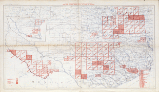
Historically, four major industries shaped the Texas economy prior to World War II: cattle and bison, cotton, timber, and oil. Before and after the U.S. Civil War, the cattle industry—which Texas came to dominate—was a major economic driver for the state, and created the traditional image of the Texas cowboy. In the later 19th century, cotton and lumber grew to be major industries as the cattle industry became less lucrative. It was ultimately, though, the discovery of major petroleum deposits (Spindletop in particular) that initiated an economic boom which became the driving force behind the economy for much of the 20th century. Texas developed a diversified economy and high tech industry during the mid-20th century. As of 2022, it has the most Fortune 500 company headquarters (53) in the United States. With a growing base of industry, the state leads in many industries, including tourism, agriculture, petrochemicals, energy, computers and electronics, aerospace, and biomedical sciences. Texas has led the U.S. in state export revenue since 2002, and has the second-highest gross state product. If Texas were a sovereign state, it would have the 10th-largest economy in the world.
The name Texas, based on the Caddo word táyshaʼ 'friend', was applied, in the spelling Tejas or Texas, by the Spanish to the Caddo themselves, specifically the Hasinai Confederacy, the final -s representing the Spanish plural. The Mission San Francisco de los Tejas was completed near the Hasinai village of Nabedaches in May 1690, in what is now Houston County, East Texas.
During Spanish colonial rule, in the 18th century, the area was known as Nuevas Filipinas ('New Philippines') and Nuevo Reino de Filipinas ('New Kingdom of the Philippines'), or as provincia de los Tejas ('province of the Tejas'), later also provincia de Texas (or de Tejas), ('province of Texas'). It was incorporated as provincia de Texas into the Mexican Empire in 1821, and declared a republic in 1836. The Royal Spanish Academy recognizes both spellings, Tejas and Texas, as Spanish-language forms of the name of the U.S. state of Texas.
The English pronunciation with is unetymological, contrary to the historical value of the letter x in Spanish orthography. Alternative etymologies of the name advanced in the late 19th century connected the name Texas with the Spanish word teja, meaning 'roof tile', the plural tejas being used to designate indigenous Pueblo settlements. A 1760s map by Jacques-Nicolas Bellin shows a village named Teijas on the Trinity River, close to the site of modern Crockett.
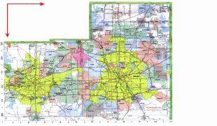
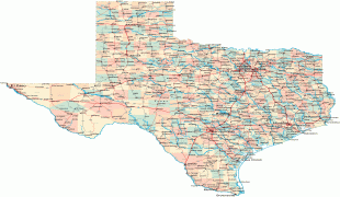
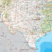
Map - Texas
Map


Country - United_States
 |
 |
| Flag of the United States | |
Indigenous peoples have inhabited the Americas for thousands of years. Beginning in 1607, British colonization led to the establishment of the Thirteen Colonies in what is now the Eastern United States. They quarreled with the British Crown over taxation and political representation, leading to the American Revolution and proceeding Revolutionary War. The United States declared independence on July 4, 1776, becoming the first nation-state founded on Enlightenment principles of unalienable natural rights, consent of the governed, and liberal democracy. The country began expanding across North America, spanning the continent by 1848. Sectional division surrounding slavery in the Southern United States led to the secession of the Confederate States of America, which fought the remaining states of the Union during the American Civil War (1861–1865). With the Union's victory and preservation, slavery was abolished nationally by the Thirteenth Amendment.
Currency / Language
| ISO | Currency | Symbol | Significant figures |
|---|---|---|---|
| USD | United States dollar | $ | 2 |
| ISO | Language |
|---|---|
| EN | English language |
| FR | French language |
| ES | Spanish language |


