Tien Giang province (Tỉnh Tiền Giang)
 |
 |
The province was formed in February 1976, by the merger of Định Tường and Gò Công provinces.
Tiền Giang has an advantage of being located between two important economic regions – the Southern Key Economic Zone (SKEZ) and the Mekong Delta. The province is a gateway to Ho Chi Minh City (HCMC) and other eastern provinces as well as those of the Mekong Delta through its system of 150 km road, one expressway, four National Roads (1, 30, 50 and 60). The coastline is 32 km long with thousands of coastal warp, which is an advantage for aquatic breeding such as crab and sea-based economic development.
Tiền Giang borders Long An province and HCMC to the north, Đồng Tháp province to the west, Bến Tre and Vĩnh Long province to the south, and the East Sea to the east. Mỹ Tho City, acting the leading role of socioeconomic and politic center of Tiền Giang, is the major junction of education, culture and tourism for nearby provinces. The city is 70 km away from Ho Chi Minh City to the south and 90 km away from Cần Thơ City to the east.
The climate here is clearly divided into two main seasons, namely wet season and dry season and the average temperature is about 27 °C, all of which help to create a diverse ecosystem. From the 17th century a lot of Vietnamese people migrated from Ngu Quang to Tiền Giang province to reclaim this deserted area, which was full of dangerous animals, turned it into vast rice fields and luxuriant orchards and built wealthy villages there. There are a variety of ecosystems such as those at sea, canals, mounds and Đồng Tháp Mười depression, each of them has typical animals and plants, which creates a variety for not only landscape but also culture for this place.
With a total area of 2,510.5 km2, Tiền Giang stretches along the north of Tiền River for 120 km, accounting for about 6% of SKEZ, and 0.7 of the national area. Overall, thanks to its geographic location, economic condition, road and waterway transportation, Tiền Giang province has various advantages in using natural resources, developing goods production, expanding consumption market for its products, reinforcing its ability of cooperation and exchange in terms of economics, culture and tourism with other provinces in the region, especially Ho Chi Minh City and the Southern Key Economic Zone.
Tiền Giang province has flat terrain with a slope below 1%, and the altitude varying from 0 - 1.6 m in comparison with the sea level. The whole province area is in the lower section of Mekong River. Its current terrain surface and land was created by the accumulation of Mekong river silt during the development process of the modern delta in the marine regression period from the mid-Holocene (about 5,000 – 4,500 years to the present), which is also called new silt. In general, because the land surface is new silt which is rich in cat dirt and organic matters; the altitude of topography surface is relatively low. Its force-bearing ability for construction is not high. Therefore, ground leveling need to be done and construction projects need to be reinforced. Deep layers are fairly rich in sand and have better geological characteristics for construction. However, the arrangement of layers is very complex and some layers with bad geological characteristics for construction mingle with good ones. Therefore, it is necessary to carefully study them before the construction of large scale or heavy load, etc. is carried out. The whole region does not have a clear slope direction but there are several zones whose terrain is lower or higher than the general terrain.
Map - Tien Giang province (Tỉnh Tiền Giang)
Map
Country - Vietnam
 |
 |
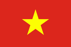
| Flag of Vietnam | |
Vietnam was inhabited by the Paleolithic age, with states established in the first millennium BC on the Red River Delta in modern-day northern Vietnam. The Han dynasty annexed Northern and Central Vietnam under Chinese rule from 111 BC, until the first dynasty emerged in 939. Successive monarchical dynasties absorbed Chinese influences through Confucianism and Buddhism, and expanded southward to the Mekong Delta, conquering Champa. The Nguyễn—the last imperial dynasty—surrendered to France in 1883. Following the August Revolution, the nationalist Viet Minh under the leadership of communist revolutionary Ho Chi Minh proclaimed independence from France in 1945.
Currency / Language
| ISO | Currency | Symbol | Significant figures |
|---|---|---|---|
| VND | Vietnamese đồng | ₫ | 0 |
| ISO | Language |
|---|---|
| KM | Central Khmer language |
| ZH | Chinese language |
| EN | English language |
| FR | French language |
| VI | Vietnamese language |


