Tombali Region (Tombali)
As of 2009, the total population of the region was 91,089, with the urban population being 12,967 and rural being 78,122. The sex ratio of the region is 94 females for every hundred males. As of 2009, the net activity rate was 54.77 per cent, proportion of employed labour force was 37.86 per cent, proportion of labour force was 75.74 and the proportion of potentially active population was 37.86 per cent, with the major economic activity being fishing. The absolute poverty rate, people earning less than $2 a day, in the region stood at 69.1 per cent, with a regional contribution of 11.2 per cent to the national poverty totals.
Tombali is a low-lying coastal region and the low-lying coastal areas are periodically submerged during high tide. All the coastal regions have a maximum elevation of 300 m. The internal region has plains, which are interspersed with rias. There are many meandering rivers, of which a substantial proportion form estuaries in the coastal regions. The principal river, Cacheu, flows through the region. The climate is tropical savanna (Köppen Aw) north of Catió and tropical monsoon (Köppen Am) south of Catió. Like all of Guinea-Bissau there are two seasons: a dry season from November to May with dusty harmattan winds and typical temperature ranges from 20 °C to 30 °C, and a monsoon wet season from May to November with temperatures consistently around 28 °C and heavy thunderstorm rains every day. The region receives an average rainfall of around 2250 mm compared to inland Guinea-Bissau, which receive 1500 mm. The coastal regions are covered with Mangrove swamps, rain forest and tangled forest.
Map - Tombali Region (Tombali)
Map
Country - Guinea-Bissau
 |
 |
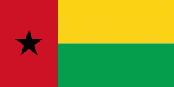
| Flag of Guinea-Bissau | |
Guinea-Bissau was once part of the kingdom of Kaabu, as well as part of the Mali Empire. Parts of this kingdom persisted until the 18th century, while a few others were under some rule by the Portuguese Empire since the 16th century. In the 19th century, it was colonised as Portuguese Guinea. Portuguese control was restricted and weak until the early 20th century with the pacification campaigns, these campaigns solidified Portuguese sovereignty in the area. The final Portuguese victory over the remaining bastion of mainland resistance, the Papel ruled Kingdom of Bissau in 1915 by the Portuguese military office Teixeira Pinto, and recruited Wolof mercenary Abdul Injai was the event to solidify mainland control. The Bissagos, islands off the coast of Guinea-Bissau, were officially conquered in 1936, ensuring Portuguese control of both the mainland and islands of the region. Upon independence, declared in 1973 and recognised in 1974, the name of its capital, Bissau, was added to the country's name to prevent confusion with Guinea (formerly French Guinea). Guinea-Bissau has a history of political instability since independence, and only one elected president (José Mário Vaz) has successfully served a full five-year term. The current president is Umaro Sissoco Embaló, who was elected on 29 December 2019.
Currency / Language
| ISO | Currency | Symbol | Significant figures |
|---|---|---|---|
| XOF | West African CFA franc | Fr | 0 |
| ISO | Language |
|---|---|
| PT | Portuguese language |


