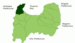
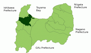
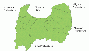
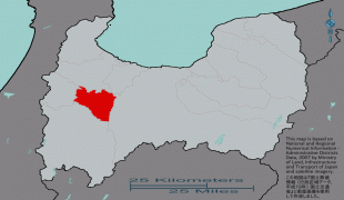
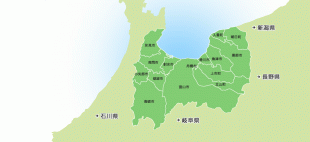
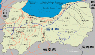
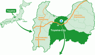
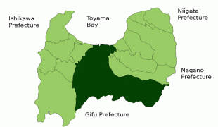
Toyama Prefecture (Toyama-ken)
 |
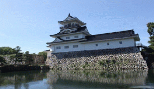
Toyama is the capital and largest city of Toyama Prefecture, with other major cities including Takaoka, Imizu, and Nanto. Toyama Prefecture is part of the historic Hokuriku region, and the majority of prefecture's population lives on Toyama Bay, one of the largest bays in Japan. Toyama Prefecture is the leading industrial prefecture on the Japan Sea coast and has the advantage of cheap electricity from abundant hydroelectric resources. Toyama Prefecture contains the only known glaciers in East Asia outside of Russia, first recognized in 2012, and 30% of the prefecture's area is designated as national parks.
Historically, Toyama Prefecture was Etchū Province. Following the abolition of the han system in 1871, Etchū Province was renamed Niikawa Prefecture, but Imizu District was given to Nanao Prefecture. In 1872 Imizu District was returned by the new Ishikawa Prefecture.
In 1876, Niikawa Prefecture was merged into Ishikawa Prefecture but the merger was void in 1881 and the area was re-established as Toyama Prefecture.
The Itai-itai disease occurred in Toyama around 1950.
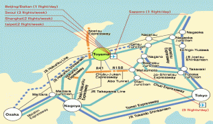
Map - Toyama Prefecture (Toyama-ken)
Map


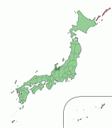


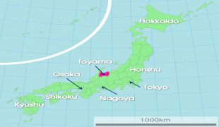
Country - Japan
 |
 |
| Flag of Japan | |
Japan is the eleventh most populous country in the world, as well as one of the most densely populated and urbanized. About three-fourths of the country's terrain is mountainous, concentrating its population of 124.8 million on narrow coastal plains. Japan is divided into 47 administrative prefectures and eight traditional regions. The Greater Tokyo Area is the most populous metropolitan area in the world, with more than 37.2 million residents.
Currency / Language
| ISO | Currency | Symbol | Significant figures |
|---|---|---|---|
| JPY | Japanese yen | ¥ | 0 |
| ISO | Language |
|---|---|
| JA | Japanese language |


