Tunapuna-Piarco Regional Corporation (Tunapuna/Piarco)
Tunapuna–Piarco is one of the most geographically diverse regions in Trinidad and Tobago. It features the country's two highest mountain peaks, El Cerro del Aripo at 3,084 feet and El Tucuche standing at a soaring 3,070 feet, which both tower the north of the region and the Northern Coast of Trinidad forming the a part of the Northern Range.
Tunapuna–Piarco is the fifth largest region in Trinidad and Tobago accounting for an area of 527.23 km2. The region has approximately 30 km (19 miles) of rugged coastline with the Caribbean Sea to the north.
The Northern Range which covers 25% of the land area of Trinidad stretches the entire Northern Coast of Trinidad from the regions of Diego Martin and San Juan–Laventille in the west and through Tunapuna–Piarco to Sangre Grande in the east, is located to the north of the region and is the largest mountain range in the country. It is home to the nation's two tallest mountain peaks, El Cerro del Aripo and El Tucuche which both exceeds 3,070 feet and is considered to be a continuation of the Andes Mountain Range on the mainland South American continent which is only 6.8 miles away from Trinidad.
Map - Tunapuna-Piarco Regional Corporation (Tunapuna/Piarco)
Map
Country - Trinidad_and_Tobago
 |
 |
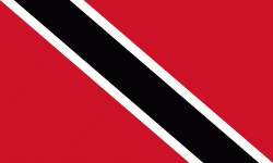
| Flag of Trinidad and Tobago | |
The island of Trinidad was inhabited for centuries by Indigenous peoples before becoming a colony in the Spanish Empire, following the arrival of Christopher Columbus, in 1498. Spanish governor José María Chacón surrendered the island to a British fleet under the command of Sir Ralph Abercromby in 1797. Trinidad and Tobago were ceded to Britain in 1802 under the Treaty of Amiens as separate states and unified in 1889. Trinidad and Tobago obtained independence in 1962, becoming a republic in 1976.
Currency / Language
| ISO | Currency | Symbol | Significant figures |
|---|---|---|---|
| TTD | Trinidad and Tobago dollar | $ | 2 |
| ISO | Language |
|---|---|
| ZH | Chinese language |
| EN | English language |
| FR | French language |
| ES | Spanish language |


