Tunis
 |
 |
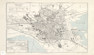
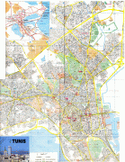
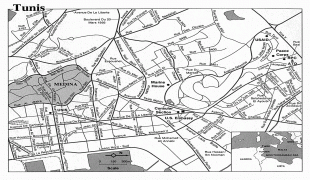
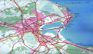
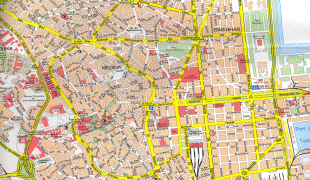
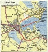
Situated on a large Mediterranean Sea gulf (the Gulf of Tunis), behind the Lake of Tunis and the port of La Goulette (Ḥalq il-Wād), the city extends along the coastal plain and the hills that surround it. At its core lies Ancient Medina, a World Heritage Site. East of the Medina, through the Sea Gate (also known as the Bab el Bhar and the Porte de France), begins the modern city "Ville Nouvelle", traversed by the grand Avenue Habib Bourguiba (often referred to by media and travel guides as "the Tunisian Champs-Élysées"), where the colonial-era buildings provide a clear contrast to smaller, older structures. Further east by the sea lie the suburbs of Carthage, La Marsa, and Sidi Bou Said. As the capital of the country, Tunis is the focus of Tunisian political and administrative life and also the center of the country's commercial and cultural activities.
Tunis is the transcription of the Arabic name تونس which can be pronounced as "Tūnus", "Tūnas", or "Tūnis". All three variations were mentioned by the Arab geographer Yaqut al-Hamawi in his Mu'jam al-Bûldan (Dictionary of Countries).
Different explanations exist for the origin of the name Tunis. Some scholars relate it to the Phoenician goddess Tanith ('Tanit or Tanut), as many ancient cities were named after patron deities. Some scholars claim that it originated from Tynes, which was mentioned by Diodorus Siculus and Polybius in the course of descriptions of a location resembling present-day Al-Kasbah, Tunis's old Berber village.
Another possibility is that it was derived from the Berber verbal root ens which means "to lie down" or "to pass the night". The term Tunis can possibly mean "camp at night", "camp", or "stop", or may have referred to as "the last stop before Carthage" by people who were journeying to Carthage by land. There are also some mentions in ancient Roman sources of such names of nearby towns as Tuniza (now El Kala), Thunusuda (now Sidi-Meskin), Thinissut (now Bir Bouregba), and Thunisa (now Ras Jebel). As all of these Berber villages were situated on Roman roads, they undoubtedly served as rest-stations or stops.
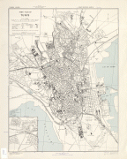
Map - Tunis
Map


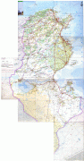
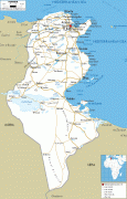


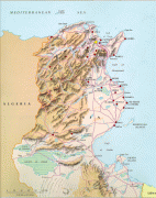


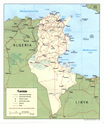
Country - Tunisia
 |
 |
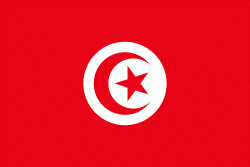
| Flag of Tunisia | |
Beginning in early antiquity, Tunisia was inhabited by the indigenous Berbers. Phoenicians began to arrive in the 12th century BC, establishing several settlements, of which Carthage emerged as the most powerful by the 7th century BC. Carthage was a major mercantile empire and a military rival to the Roman Republic until 146 BC, when it was defeated by the Romans who occupied Tunisia for most of the next 800 years. The Romans introduced Christianity and left architectural legacies like the Amphitheatre of El Jem. In the 7th century AD, Arab Muslims conquered all of Tunisia (finally succeeding in 697 after several attempts starting in 647) and settled with their tribes and families, brought Islam and Arab culture to the local inhabitants, and since then Arabs became the majority of the population. Then, in 1546, the Ottoman Empire established control there, holding sway for over 300 years, until 1881, when the French conquered Tunisia. In 1956, Tunisia gained independence as the Tunisian Republic under the leadership of Habib Bourguiba with the help of activists such as Chedly Kallala, Farhat Hached and Salah Ben Youssef. Today, Tunisia's culture and identity are rooted in this centuries-long intersection of different cultures and ethnicities.
Currency / Language
| ISO | Currency | Symbol | Significant figures |
|---|---|---|---|
| TND | Tunisian dinar | دت | 3 |
| ISO | Language |
|---|---|
| AR | Arabic language |
| FR | French language |