V. C. Bird International Airport (V. C. Bird International Airport)
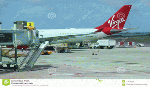
V. C. Bird International Airport is an international airport located on the island of Antigua, 8 km northeast of St. John's, the capital of Antigua and Barbuda.
The airport originally was operated by the United States Army Air Forces.
The airport was built as a United States Army Air Forces base around 1941 and named Coolidge Airfield after Capt. Hamilton Coolidge (1895–1918), a United States Army Air Service pilot killed in World War I.
Flying units assigned to the airfield were:
* 35th Bombardment Squadron (25th Bombardment Group) 11 November 1941 until November 1942
* 12th Bombardment Squadron (25th Bombardment Group) 23 November 1943 until 24 March 1944
* 4th Tactical Reconnaissance Squadron (Antilles Air Command) 21 May until 5 October 1945
Renamed Coolidge Air Force Base in 1948, it was closed as a result of budgetary cutbacks in 1949, with the right of re-entry retained by the United States. Agreements were subsequently reached with the United Kingdom and, later, the Antigua government upon independence, for the establishment and maintenance of missile tracking facilities. Antigua Air Station was established on a portion of the former Coolidge AFB. , NASA continues to utilize the Antigua facility for launch tracking services on an as-needed basis; and did so for the launch of the Mars Science Laboratory on 26 November 2011.
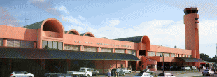
Upon the closure of the base in 1949, it became a civil airport. It was known as Coolidge International Airport until 1985 when it was named in honour of Sir Vere Cornwall Bird (1910–1999), the first prime minister of Antigua and Barbuda.
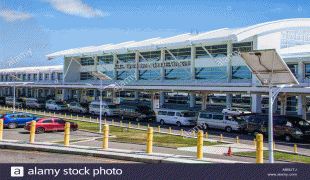
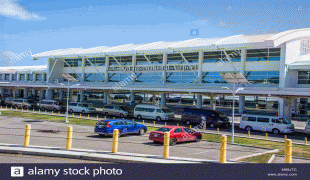
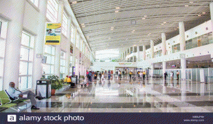
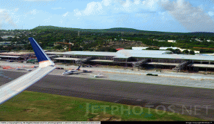
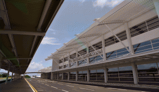
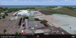
In December 2005, the Antigua and Barbuda Millennium Airport Corporation announced it would invite tenders to construct the first phase of a new passenger terminal designed to serve the airport for 30 years. In 2012, they announced the construction of its second terminal.
The airport originally was operated by the United States Army Air Forces.
The airport was built as a United States Army Air Forces base around 1941 and named Coolidge Airfield after Capt. Hamilton Coolidge (1895–1918), a United States Army Air Service pilot killed in World War I.
Flying units assigned to the airfield were:
* 35th Bombardment Squadron (25th Bombardment Group) 11 November 1941 until November 1942
* 12th Bombardment Squadron (25th Bombardment Group) 23 November 1943 until 24 March 1944
* 4th Tactical Reconnaissance Squadron (Antilles Air Command) 21 May until 5 October 1945
Renamed Coolidge Air Force Base in 1948, it was closed as a result of budgetary cutbacks in 1949, with the right of re-entry retained by the United States. Agreements were subsequently reached with the United Kingdom and, later, the Antigua government upon independence, for the establishment and maintenance of missile tracking facilities. Antigua Air Station was established on a portion of the former Coolidge AFB. , NASA continues to utilize the Antigua facility for launch tracking services on an as-needed basis; and did so for the launch of the Mars Science Laboratory on 26 November 2011.
Upon the closure of the base in 1949, it became a civil airport. It was known as Coolidge International Airport until 1985 when it was named in honour of Sir Vere Cornwall Bird (1910–1999), the first prime minister of Antigua and Barbuda.
In December 2005, the Antigua and Barbuda Millennium Airport Corporation announced it would invite tenders to construct the first phase of a new passenger terminal designed to serve the airport for 30 years. In 2012, they announced the construction of its second terminal.
| IATA Code | ANU | ICAO Code | TAPA | FAA Code | |
|---|---|---|---|---|---|
| Telephone | Fax | ||||
| Home page |
Map - V. C. Bird International Airport (V. C. Bird International Airport)
Map


Country - Antigua_and_Barbuda
 |
 |
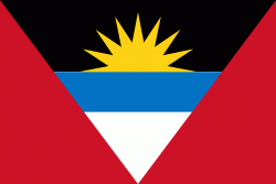
| Flag of Antigua and Barbuda | |
The country consists of two major islands, Antigua and Barbuda, which are approximately 40 km apart, and several smaller islands, including Great Bird, Green, Guiana, Long, Maiden, Prickly Pear, York, and Redonda. The permanent population is approximately 97,120 ( estimates), with 97% residing in Antigua. St. John's, Antigua, is the country's capital, major city, and largest port. Codrington is Barbuda's largest town.
Currency / Language
| ISO | Currency | Symbol | Significant figures |
|---|---|---|---|
| XCD | East Caribbean dollar | $ | 2 |
| ISO | Language |
|---|---|
| EN | English language |