Volyn Oblast (Volynska Oblast)
 |
 |
Volyn was once part of the Kyivan Rus' before becoming an independent local principality and an integral part of the Halych-Volynia, one of Kyivan Rus' successor states. In the 15th century, the area came under the control of the neighbouring Grand Duchy of Lithuania, in 1569 passing over to Poland and then in 1795, until World War I, to the Russian Empire where it was a part of the Volynskaya Guberniya. In the interwar period, most of the territory, organized as Wołyń Voivodeship was under Polish control.
In 1939 when Poland was invaded and divided by Nazi Germany and the Soviet Union following the Molotov-Ribbentrop pact, Volyn was joined to Soviet Ukraine, and on December 4, 1939, the oblast was organized.
Many Ukrainians rejoiced at the "reunification", but the Polish minority suffered a cruel fate. Thousands of Poles, especially retired Polish officers and intelligentsia were deported to Siberia and other areas in the depths of the Soviet Union. A high proportion of these deportees died in the extreme conditions of Soviet labour camps and most were never able to return to Volyn again.
In 1941 Volyn along with the Soviet Union was invaded by the Nazi Germany's Barbarossa Offensive. Nazis alongside Ukrainian collaborators completed their holocaust of the Jews of Volhynia in late 1942.
Partisan activity started in Volyn in 1941, soon after German occupation. Partisans were involved in the Rail war campaign against German supply lines and were known for their efficiency in gathering intelligence and for sabotage. The region formed the basis of several networks and many members of the local population served with the partisans. The Poles in the area became part of the Polish Home Army, which often undertook operations with the partisan movement.
UPA initially supported Nazi Germany which had in turn supported them with financing and weaponry before the start of World War II. Many served in the various RONA and SS units. Once they became disillusioned with the Nazi program, they independently began to target all non-Ukrainians (Poles, Jews, Russians, among others) for extermination. Some 30,000 to 60,000 Poles, Czechs, remaining Jews, and Ukrainians who tried to help others escape (Polish sources gave even higher figures) and later, around 2,000 or more Ukrainians were killed in retaliation (see Massacres of Poles in Volhynia).
In January 1944 the Red Army recaptured the territory from the Nazis.
In the immediate aftermath of World War II the Polish-Soviet border was redrawn based on the Curzon line. Volyn, along with the neighbouring provinces became an integral part of the Ukrainian SSR. Most Poles who remained in the eastern region were forced to leave to the Recovered Territories of western Poland (the former easternmost provinces of Germany) whose German population had been expelled. Some of the Ukrainians on the western side, notably around the city of Kholm (Chełm in Polish), were also forcibly relocated to Ukraine.
The area underwent rapid industrialisation including the construction of the Lutskiy Avtomobilnyi Zavod. Nevertheless, the area remains one of the most rural throughout the former Soviet Union.
Map - Volyn Oblast (Volynska Oblast)
Map


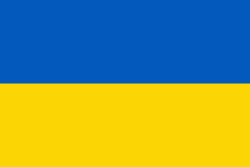
Country - Ukraine
 |
 |
| Flag of Ukraine | |
During the Middle Ages, Ukraine was the site of early Slavic expansion and the area later became a key centre of East Slavic culture under the state of Kievan Rus', which emerged in the 9th century. The state eventually disintegrated into rival regional powers and was ultimately destroyed by the Mongol invasions of the 13th century. The area was then contested, divided, and ruled by a variety of external powers for the next 600 years, including the Polish–Lithuanian Commonwealth, the Austrian Empire, the Ottoman Empire, and the Tsardom of Russia. The Cossack Hetmanate emerged in central Ukraine in the 17th century, but was partitioned between Russia and Poland, and ultimately absorbed by the Russian Empire. Ukrainian nationalism developed, and following the Russian Revolution in 1917, the short-lived Ukrainian People's Republic was formed. The Bolsheviks consolidated control over much of the former empire and established the Ukrainian Soviet Socialist Republic, which became a constituent republic of the Soviet Union when it was formed in 1922. In the early 1930s, millions of Ukrainians died in the Holodomor, a man-made famine. During World War II, Ukraine was devastated by the German occupation.
Currency / Language
| ISO | Currency | Symbol | Significant figures |
|---|---|---|---|
| UAH | Ukrainian hryvnia | â‚´ | 2 |
| ISO | Language |
|---|---|
| HU | Hungarian language |
| PL | Polish language |
| RU | Russian language |
| UK | Ukrainian language |