Vyshneve
 |
 |
In 1886, a railway station was built on this site; at the time, the nearest settlement was the village of Zhuliany (Ukrainian Жуляни), so the railway station was given the name "Zhuliany" after the village. In 1912, people started settling around the station.
During the Russian Civil War (1917–1921) the Red and White armies fought here. The population increased during the times of Joseph Stalin's forced collectivization policies (1928–1940), when peasants were settled near the station.
During World War II, Vyshneve became a battlefield. Soviet and German troops fought there until 8 August 1941. After the war, 365 inhabitants received awards for glory and heroism.
Between 1946–1956 the modern town of Vyshneve was built. A school was opened, a town council was formed and new streets were constructed. By 1960 the population had reached 4000. In 1971 the settlement of Vyshneve was officially proclaimed by the Ukrainian Higher Council (parliament) as a town.
Vyshneve's population was 34,465 at the time of the 2001 Ukrainian census. The town has four schools, five kindergartens, a cinema, a clinic, two churches, a hospital and other elements of a modern town.
The chairman of the city is Illya Dikov.
Until 18 July 2020, Vyshneve belonged to Kyiv-Sviatoshyn Raion. The raion was abolished that day as part of the administrative reform of Ukraine, which reduced the number of raions of Kyiv Oblast to seven. The area of Kyiv-Sviatoshyn Raion was split between Bucha, Fastiv, and Obukhiv Raions, with Vyshneve being transferred to Bucha Raion.
Map - Vyshneve
Map


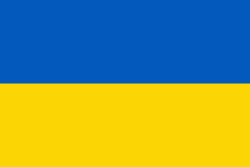
Country - Ukraine
 |
 |
| Flag of Ukraine | |
During the Middle Ages, Ukraine was the site of early Slavic expansion and the area later became a key centre of East Slavic culture under the state of Kievan Rus', which emerged in the 9th century. The state eventually disintegrated into rival regional powers and was ultimately destroyed by the Mongol invasions of the 13th century. The area was then contested, divided, and ruled by a variety of external powers for the next 600 years, including the Polish–Lithuanian Commonwealth, the Austrian Empire, the Ottoman Empire, and the Tsardom of Russia. The Cossack Hetmanate emerged in central Ukraine in the 17th century, but was partitioned between Russia and Poland, and ultimately absorbed by the Russian Empire. Ukrainian nationalism developed, and following the Russian Revolution in 1917, the short-lived Ukrainian People's Republic was formed. The Bolsheviks consolidated control over much of the former empire and established the Ukrainian Soviet Socialist Republic, which became a constituent republic of the Soviet Union when it was formed in 1922. In the early 1930s, millions of Ukrainians died in the Holodomor, a man-made famine. During World War II, Ukraine was devastated by the German occupation.
Currency / Language
| ISO | Currency | Symbol | Significant figures |
|---|---|---|---|
| UAH | Ukrainian hryvnia | â‚´ | 2 |
| ISO | Language |
|---|---|
| HU | Hungarian language |
| PL | Polish language |
| RU | Russian language |
| UK | Ukrainian language |