Vágar (Vága Sýsla)
Vágar (Vågø) is one of the 18 islands in the archipelago of the Faroe Islands and the most westerly of the large islands. With a size of 178 km2, it ranks number three, behind Streymoy and Eysturoy. Vágar region also comprises the island of Mykines.
The Vágar island shape is very distinctive, since on maps it resembles a dog's head. The fjord Sørvágsfjørður is the mouth and the lake Fjallavatn is the eye.
Vágar is the first port of call for most foreigners travelling to the Faroe Islands, as it is home to the islands’ only airport, Vágar Airport. An airfield was built there during World War II by the British, who occupied the Faroe Islands with the islanders' consent. After the war it lay unused for about 20 years, but was then put back into service and expanded/modernised as required. It handles about 290,000 passengers a year (2016). Such large numbers by Faroese standards put a considerable strain on transport facilities, with the result that a road tunnel (Vágatunnilin) measuring 5 km in length and running under the sea now connects Vágar with the two largest islands in the Faroes and thus the capital Tórshavn.
Map - Vágar (Vága Sýsla)
Map


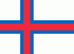
Country - Faroe_Island
 |
 |
They are located 200 mi north-northwest of the United Kingdom, and about halfway between Norway (360 mi away) and Iceland (270 mi away). The islands form part of the Kingdom of Denmark, along with mainland Denmark and Greenland. The islands have a total area of about 540 sqmi with a population of 54,000 as of June 2022.
Currency / Language
| ISO | Currency | Symbol | Significant figures |
|---|---|---|---|
| DKK | Danish krone | kr | 2 |
| ISO | Language |
|---|---|
| DA | Danish language |
| FO | Faroese language |