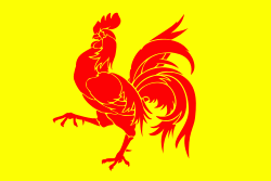
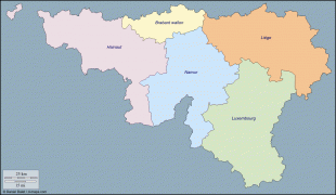
Wallonia
 |
 |
There is a German-speaking minority in eastern Wallonia, resulting from the annexation of three cantons previously part of the German Empire at the conclusion of World War I. This community represents less than 1% of the Belgian population. It forms the German-speaking Community of Belgium, which has its own government and parliament for culture-related issues.
During the industrial revolution, Wallonia was second only to the United Kingdom in industrialization, capitalizing on its extensive deposits of coal and iron. This brought the region wealth, and from the beginning of the 19th to the middle of the 20th century, Wallonia was the more prosperous half of Belgium. Since World War II, the importance of heavy industry has greatly diminished, and the Flemish Region has exceeded Wallonia in wealth as Wallonia has declined economically. Wallonia now suffers from high unemployment and has a significantly lower GDP per capita than Flanders. The economic inequalities and linguistic divide between the two are major sources of political conflicts in Belgium and a major factor in Flemish separatism.
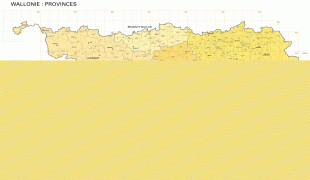
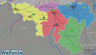
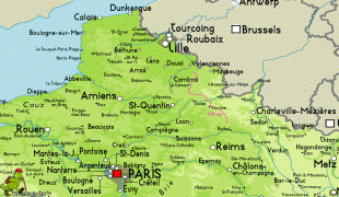
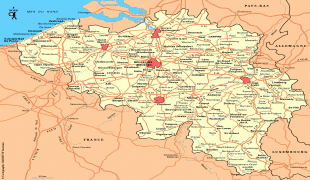
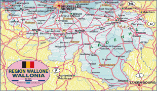
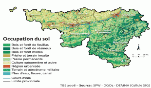
The capital of Wallonia is Namur, and the most populous city is Charleroi. Most of Wallonia's major cities and two-thirds of its population lie along the east–west aligned Sambre and Meuse valley, the former industrial backbone of Belgium. To the north of this valley, Wallonia lies on the Central Belgian Plateau, which, like Flanders, is a relatively flat and agriculturally fertile area. The south and southeast of Wallonia is made up of the Ardennes, an expanse of forested highland that is less densely populated.
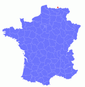
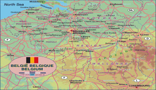
Wallonia borders Flanders and the Netherlands (the province of Limburg) in the north, France (Grand Est and Hauts-de-France) to the south and west, and Germany (North Rhine-Westphalia and Rhineland-Palatinate) and Luxembourg (Capellen, Clervaux, Esch-sur-Alzette, Redange and Wiltz) to the east. Wallonia has been a member of the Organisation Internationale de la Francophonie since 1980.
The term "Wallonia" can mean slightly different things in different contexts. One of the three federal regions of Belgium is still constitutionally defined as the "Walloon Region" as opposed to "Wallonia", but the regional government has renamed itself Wallonia, and it is commonly called Wallonia. Preceding 1 April 2010, when the renaming came into effect, Wallonia would sometimes refer to the territory governed by the Walloon Region, whereas Walloon Region referred specifically to the government. In practice, the difference between the two terms is small and what is meant is usually clear, based on context.
Wallonia is a cognate of terms such as Wales, Cornwall and Wallachia, ultimately also related to words Celt and Belgae, phonetically evolved over centuries. The Germanic word Walha, meaning the strangers, referred to Gallic or Celtic people. Wallonia is named after the Walloons, a group of locals who natively speak Romance languages. In Middle Dutch (and French), the term Walloons included both historical secular Walloon principalities, as well as the French-speaking population of the Prince-Bishopric of Liège or the whole population of the Romanic sprachraum within the medieval Low Countries.
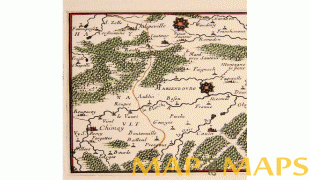
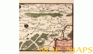
Map - Wallonia
Map


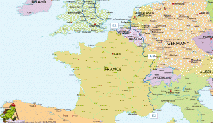


Country - Belgium
 |
 |
| Flag of Belgium | |
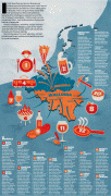
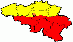
Belgium is a sovereign state and a federal constitutional monarchy with a parliamentary system. Its institutional organization is complex and is structured on both regional and linguistic grounds. It is divided into three highly autonomous regions: the Flemish Region (Flanders) in the north, the Walloon Region (Wallonia) in the south, and the Brussels-Capital Region. Brussels is the smallest and most densely populated region, as well as the richest region in terms of GDP per capita. Belgium is also home to two main linguistic communities: the Flemish Community, which constitutes about 60 percent of the population, and the French Community, which constitutes about 40 percent of the population. A small German-speaking Community, numbering around one percent, exists in the East Cantons. The Brussels-Capital Region is officially bilingual in French and Dutch, although French is the dominant language.
Currency / Language
| ISO | Currency | Symbol | Significant figures |
|---|---|---|---|
| EUR | Euro | € | 2 |
| ISO | Language |
|---|---|
| NL | Dutch language |
| FR | French language |
| DE | German language |


