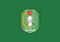
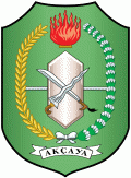
West Kalimantan (Provinsi Kalimantan Barat)
 |
 |
West Kalimantan is an area that could be dubbed "The Province of a Thousand Rivers". The nickname is aligned with the geographical conditions that have hundreds of large and small rivers that can be and often are navigable. Several major rivers are still the main route for freight to the hinterland, despite road infrastructure now reaching most districts.
Although a small part of West Kalimantan region is seawater, West Kalimantan has dozens of large and small islands (mostly uninhabited) spread along the Karimata Strait and Natuna Sea that borders the province of Riau Islands. The total population in the province, according to the 2010 census totalled 4,395,983 inhabitants and at the 2020 Census it was 5,414,390, but by mid 2021 it was officially estimated to have reached 5,470,797.
The history of West Kalimantan was mostly Hindu and Buddhist with numerous kingdoms ruling over the region and Borneo as a whole. Its modern history can be traced back to the 17th century. Dayaks were the main inhabitants of the province before the 17th century. The Malays are the native Muslims of West Kalimantan and established their own sultanate. Similar to most parts of Borneo, many of the Malays in West Kalimantan were also partly descended from the Malayalised Dayaks. The high Chinese population in this province was due to a republic founded by Chinese miners called Lanfang Republic (蘭芳共和國: Republik Lanfang), an autonomous state allied with Pontianak and Sambas Sultanate, as a substate of Qing. The government of Lanfang Republic was ended in West Kalimantan after the Dutch occupation in 1884.
West Kalimantan was under Japanese occupation from 1942 to 1945, when Indonesia declared its Independence. During the Japanese occupation, more than 21,000 people in Pontianak (including sultans, men, women and children) were kidnapped, tortured and massacred by Japanese troops during the Pontianak incidents. All the Malay Sultans on Kalimantan were executed and the Malay elite was devastated by the Japanese.
The massacre occurred in 1943-1944 and most of the victims were buried in several giant wells in Mandor (88 km from Pontianak). After the end of the war, the Japanese officers in Pontianak were arrested by allied troops and brought in front of an international military tribune.
A monument called Makam Juang Mandor was created to remember this tragic event.
On 12 May 1947, the autonomous region of West Kalimantan was established. It was led by Syarif Hamid II of Pontianak, who supported the Dutch endeavor to establish a federal United States of Indonesia (RUSI), of which West Kalimantan would be one component. Following the 5 April 1950 arrest of Sultan Hamid for complicity in a coup attempt against the RUSI government led by Royal Netherlands East Indies Army (KNIL) officer Raymond Westerling, there were demands from the public for a merger into the Republic of Indonesia, which took place on 22 April. On 15 August, The West Kalimantan autonomous region became part of Kalimantan Province, and two days later, the RUSI ceased to exist, and was replaced with a unitary Republic of Indonesia.
West Kalimantan was the site of substantial fighting during the Indonesia-Malaysia confrontation under the Sukarno government in the mid-1960s. After Suharto deposed Sukarno in 1965, the confrontation was quickly resolved. Domestic conflict continued, however, for another ten years between the new military Suharto government and fighters organized during the confrontation and backed by the banned Indonesian Communist Party (PKI). (see Indonesian killings of 1965–66)
During the 1930s the Dutch colonial powers initiated a "transmigration plan" to move people from heavily populated islands such as Java, to the less populated islands of Irian Jaya and Kalimantan. In the 1960s the Indonesian government granted the Madurese rights to clear forests for palm oil cultivation. This conflicted with the local Dayak tribes' traditional way of life. The tensions between the two ethnic groups resulted in major eruptions of violence in 1996, the Sambas riots in 1999 and the Sampit conflict in 2001, resulting in thousands of deaths.
Map - West Kalimantan (Provinsi Kalimantan Barat)
Map
Country - Indonesia
 |
 |
| Flag of Indonesia | |
As the world's third largest democracy, Indonesia is a presidential republic with an elected legislature. It has 38 provinces, of which nine have special status. The country's capital, Jakarta, is the world's second-most populous urban area. Indonesia shares land borders with Papua New Guinea, East Timor, and the eastern part of Malaysia, as well as maritime borders with Singapore, Vietnam, Thailand, the Philippines, Australia, Palau, and India. Despite its large population and densely populated regions, Indonesia has vast areas of wilderness that support one of the world's highest level of biodiversity.
Currency / Language
| ISO | Currency | Symbol | Significant figures |
|---|---|---|---|
| IDR | Indonesian rupiah | Rp | 2 |
| ISO | Language |
|---|---|
| NL | Dutch language |
| EN | English language |
| ID | Indonesian language |
| JV | Javanese language |


