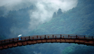
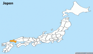
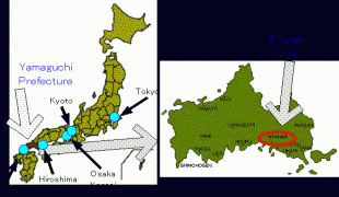
Yamaguchi Prefecture (Yamaguchi)
 |
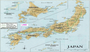
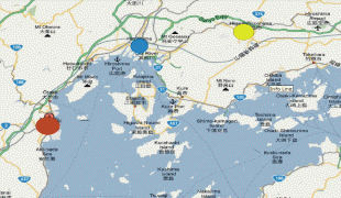
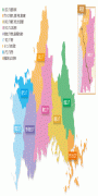
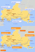
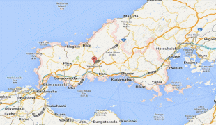
Yamaguchi is the capital and Shimonoseki is the largest city of Yamaguchi Prefecture, with other major cities including Ube, Shūnan, and Iwakuni. Yamaguchi Prefecture is located at the western tip of Honshu with coastlines on the Sea of Japan and Seto Inland Sea, and separated from the island of Kyushu by the Kanmon Straits.
Yamaguchi Prefecture was created by the merger of the provinces of Suō and Nagato. During the rise of the samurai class during the Heian and Kamakura Periods (794–1333), the Ouchi family of Suō Province and the Koto family of Nagato Province gained influence as powerful warrior clans. In the Muromachi period (1336—1573), Ouchi Hiroyo, the 24th ruler of the Ouchi family conquered both areas of Yamaguchi Prefecture. The Ouchi clan imitated the city planning of Kyoto. They gained great wealth through cultural imports from the continent and trade with Korea and Ming Dynasty China. As a result, Yamaguchi came to be known as the "Kyoto of the West," and Ouchi culture flourished. Sue Harutaka defeated the 31st ruler of the Ouchi clan. The Sue clan was then defeated by Mōri Motonari, and the Mōri family gained control of the Chūgoku region. Yamaguchi was ruled as part of the Mōri clan domain during the Sengoku period. Mōri Terumoto was then defeated by Tokugawa Ieyasu in the battle of Sekigahara in 1600. He was forced to give up all his land except for the Suō and Nagato areas (current-day Yamaguchi Prefecture), where he built his castle in Hagi. Mōri sought to strengthen the economic base of the region and increase local production with his Three Whites campaign (salt, rice, and paper).
After Commodore Matthew Perry's opening of Japan, clans from Nagato (also called Chōshū) played a key role in the fall of the Tokugawa shogunate and the establishment of the new imperial government. Four years after the Edo Shogunate was overthrown and the Meiji government formed in 1868, the present Yamaguchi Prefecture was established. The Meiji government brought in many new systems and modern policies, and promoted the introduction of modern industry, though the prefecture was still centered on agriculture during this period. In the Taishō period, from 1912 to 1926, shipbuilding, chemical, machinery, and metal working plants were built in Yamaguchi's harbors in the Seto Inland Sea area. During the post-World War II Shōwa Period, Yamaguchi developed into one of the most industrialized prefectures in the country due to the establishment of petrochemical complexes.
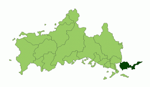
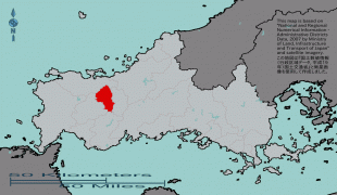
Map - Yamaguchi Prefecture (Yamaguchi)
Map


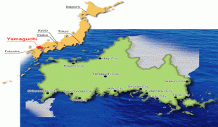

Country - Japan
 |
 |
| Flag of Japan | |
Japan is the eleventh most populous country in the world, as well as one of the most densely populated and urbanized. About three-fourths of the country's terrain is mountainous, concentrating its population of 124.8 million on narrow coastal plains. Japan is divided into 47 administrative prefectures and eight traditional regions. The Greater Tokyo Area is the most populous metropolitan area in the world, with more than 37.2 million residents.
Currency / Language
| ISO | Currency | Symbol | Significant figures |
|---|---|---|---|
| JPY | Japanese yen | ¥ | 0 |
| ISO | Language |
|---|---|
| JA | Japanese language |
