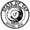
Yap State (State of Yap)
 |
 |
Colonia is the capital of Yap State, which administers both the Yap Main Islands and the island of Satawal, as well as fourteen atolls reaching to the east and south for some 800 km. Historically, a tributary system existed between the Neighboring Islands and the Yap Main Islands. This probably related to the need for goods from the high islands, including food, as well as wood for construction of seagoing vessels.
According to the FSM Statistics Office, the population of Colonia and the municipalities of the State of Yap was 11,577 in 2020. The state has a total land area of 102 km2.
The islands are thought to have been populated from the Malay Archipelago. In approximately 950 AD it was the seat of the Yapese Empire contemporary to the Tu'i Tonga Empire. The outer islands, now part of the Yap state, were settled from Polynesia.
The island nation formerly used stone disks as currency. Since this stone money had to be made from a rock that could not be extracted on the island, its value derived from the dangers taken on expeditions to obtain it, mostly from Palau.
The first Westerners to visit the island were the Portuguese in 1525 when the navigator Diego Da Rocha arrived in Ulithi and stayed there for four months.
The Caroline Islands were under Spanish rule from the 16th century until the end of the 19th century, but most of the communities on the islands of the present state of Yap had little contact with Europeans and lived in complete independence. In 1885, following a conflict between Spain and Germany, the arbitration of Pope Leo XIII confirmed possession to Spain against commercial advantages for Germany. On June 30, 1899, after the Spanish–American War, Spain sold the Carolines, the Palau Islands and the majority of the Marianas to the German Empire. At the start of the First World War, in 1914, the Empire of Japan occupied the area. This occupation was formally recognized within the framework of the Mandate of the Pacific Islands created in 1919 by the League of Nations.
The Caroline Islands came under the control of the United States in 1944, which administered them as a Trust Territory of the Pacific Islands under a UN mandate received in 1947. On May 10, 1979, Yap ratified the Constitution of the Federated States of Micronesia and became an integral part of this new nation with official independence on November 3, 1986. The state was once the Yap District of the Trust Territory of the Pacific Islands.
Map - Yap State (State of Yap)
Map
Country - Federated_States_of_Micronesia
 |
 |
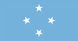
| Flag of the Federated States of Micronesia | |
While the FSM's total land area is quite small, the country's waters occupy nearly 3 e6km2 of the Pacific Ocean, giving the country the 14th-largest exclusive economic zone in the world. The sovereign island nation's capital is Palikir, located on Pohnpei Island, while the largest city is Weno, located in the Chuuk Atoll.
Currency / Language
| ISO | Currency | Symbol | Significant figures |
|---|---|---|---|
| USD | United States dollar | $ | 2 |
| ISO | Language |
|---|---|
| EN | English language |


