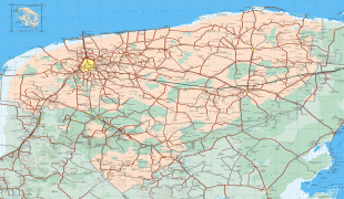
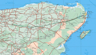
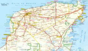
Yucatán (Estado de Yucatán)
 |
 |
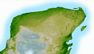
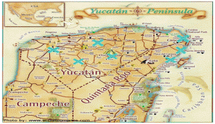
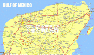
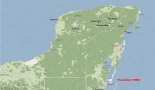
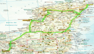
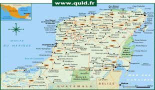
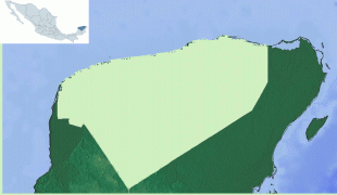
It is located on the northern part of the Yucatán Peninsula. It is bordered by the states of Campeche to the southwest and Quintana Roo to the southeast, with the Gulf of Mexico off its northern coast.
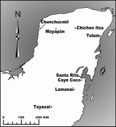
Before the arrival of Spaniards in the Yucatán Peninsula, the name of this region was Mayab. In the Yucatec Maya language, mayab means "flat", and is the source of the word "Maya" itself. The peninsula was a very important region for the Maya civilization, which reached the peak of its development here, where the Mayans founded the cities of Chichen Itza, Izamal, Motul, Mayapan, Ek' Balam, and Ichcaanzihóo (also called Ti'ho), now Mérida.
After the Spanish conquest of Yucatán (early 16th to late 17th centuries), the Yucatán peninsula became a single administrative and political entity, the Captaincy General of Yucatán. Following Mexican independence in 1821 the local Governor proclaimed independence. Yucatán became part of the Mexican Empire in December 1821. After the collapse of the first Mexican Empire in March 1823, the first Republic of Yucatán (founded in May 1823) voluntarily negotiated annexation to the Federal Republic of United Mexican States on December 21, 1823. On March 16, 1841, as a result of cultural and political conflicts around the federal pact, Yucatán declared its independence from Mexico. forming a second Republic of Yucatán. Eventually on July 14, 1848, Yucatán was forced to rejoin Mexico. In 1858, in the middle of the Caste War of Yucatán, the state of Yucatán was divided for the first time, establishing Campeche as a separate state (officially in 1863). During the Porfiriato, in 1902, the state of Yucatán was divided again to form the Federal territory that later became the present state of Quintana Roo.
the Mexican National Public Security System ranked Yucatán as "one of the safest states in Mexico". Mérida was awarded City of Peace in 2011.
The name Yucatán, also assigned to the peninsula, came from early explorations of the Conquistadors from Europe. Three different explanations for the origin of the name have been proposed.
The first is that the name resulted from confusion between the Mayan inhabitants and the first Spanish explorers around 1517:
* According to one of them, Spaniards gave the name of Yucatán to the region, because the Mayan answered their questions with the phrase uh yu ka t'ann, which in the Maya language means hear how they talk.
* It is also said that it came from the answer of an indigenous Mayan to the question of a Spanish explorer, who wanted to know the name of the region. The Mayan probably replied Ma'anaatik ka t'ann which means in the Maya language I do not understand your speech or I do not understand you.
Probably the first person to propose the "I do not understand" version was the friar Toribio de Benavente Motolinia. In his book Historia de los indios de la Nueva España (History of the Indians of New Spain) he says "because talking with those Indians of the coast, whatever the Spanish asked the Indians responded: Tectetán, Tectetán which means I don't understand you, I don't understand you; they corrupted the word, and not understanding what the Indians said, they said: Yucatán is the name of this land; and the same happened in a place, a cape, which they also called Cape Cotoch; and Cotoch in that language means house."
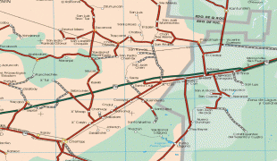
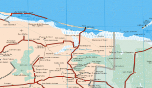
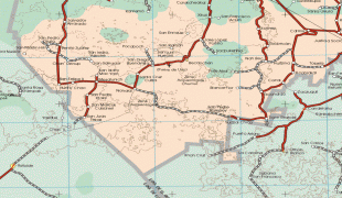
Map - Yucatán (Estado de Yucatán)
Map


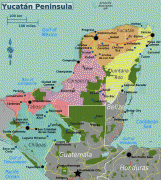


Country - Mexico


Currency / Language
| ISO | Currency | Symbol | Significant figures |
|---|---|---|---|
| MXV | Mexican Unidad de Inversion | 2 | |
| MXN | Mexican peso | $ | 2 |
| ISO | Language |
|---|---|
| ES | Spanish language |

