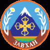
Zavkhan Province (Dzavhan Aymag)
 |
Locally, Zavkhan's environment is considered "Gobi-Khangai" (Говь хангай), since it connects the Gobi Desert in the south with the western Khangai Mountain Range and the broad lake basin of Khovd aimag.
The highest peak in the province is Otgontenger (Отгонтэнгэр, lit. "youngest sky") both the highest (4,031 m) and only peak in the Khangai range capped with a permanent glacier. The mountain is located in the 95,510 hectare Otgon Tenger Strictly Protected Area, about 60 km east of Uliastai. An image of the mountain can be seen on the aimag's coat of arms. Otgontenger is associated with the Bodhisattva Ochirvaani (Очирваань).
The western and south-western regions of Zavkhan contain the massive Bor Khyarin Els sand dunes that stretch for over 100 km within the Zavkhan, down into Gobi-Altai aimag. One of the largest lakes in Zavkhan, Bayan Nuur (баян нуур, "rich lake") is nestled among the dunes.
Map - Zavkhan Province (Dzavhan Aymag)
Map


Country - Mongolia
 |
|
| Flag of Mongolia | |
The territory of modern-day Mongolia has been ruled by various nomadic empires, including the Xiongnu, the Xianbei, the Rouran, the First Turkic Khaganate, and others. In 1206, Genghis Khan founded the Mongol Empire, which became the largest contiguous land empire in history. His grandson Kublai Khan conquered China proper and established the Yuan dynasty. After the collapse of the Yuan, the Mongols retreated to Mongolia and resumed their earlier pattern of factional conflict, except during the era of Dayan Khan and Tumen Zasagt Khan. In the 16th century, Tibetan Buddhism spread to Mongolia, being further led by the Manchu-founded Qing dynasty, which absorbed the country in the 17th century. By the early 20th century, almost one-third of the adult male population were Buddhist monks. After the collapse of the Qing dynasty in 1911, Mongolia declared independence, and achieved actual independence from the Republic of China in 1921. Shortly thereafter, the country became a satellite state of the Soviet Union, which had aided its independence from China. In 1924, the Mongolian People's Republic was founded as a socialist state. After the anti-communist revolutions of 1989, Mongolia conducted its own peaceful democratic revolution in early 1990. This led to a multi-party system, a new constitution of 1992, and transition to a market economy.
Currency / Language
| ISO | Currency | Symbol | Significant figures |
|---|---|---|---|
| MNT | Mongolian tögrög | ₮ | 2 |
| ISO | Language |
|---|---|
| MN | Mongolian language |
| RU | Russian language |