İsmayıllı (Ismayilli Rayon)
Ismayilli (İsmayıllı) is a city and the capital of the Ismayilli District of Azerbaijan. It has a population of 28,776 in 2021
The territory of the district was part of the Albania state, which was formed in the late 4th century and early 3rd century BC, long before it was erected. Historical facts prove that Mehranis, who belonged to Javanshir, had created Girdiman's prince in Ismayilli territory. Javanshir was of this generation. There is a fortress called Javanshir on the coast of Akchay, 4 km north of the village of Talantan. Ismayilli district, located in the northeastern part of Azerbaijan, was founded in 1931. At first, the administrative centre of the district was in the Basgal village and was soon transferred to Ismayilli village. Until the district was organized, a large part of its territory was part of the Goychay accident, part of the Shamakhi accident, and a small part of Sheki's accident. Ismayilli was the village until 1959, until 1967, it was a city-type settlement, and then it was renamed the city. Ismayilli region was established on November 24, 1931. From 1939 to 1977 the executive committee of the Soviet Union of deputies of the Ismayilli district, acting as the Executive Committee of the Council of People's Deputies of Ismayilli region from October 7, 1977, till October 17, 1991. In accordance with the Decree of the President of the Republic of Azerbaijan dated October 18, 1991, the Soviet of People's Deputies of Ismayilli was abolished, and the Ismayilli Executive Authority was established and functioned since November 1991.
The territory of the district was part of the Albania state, which was formed in the late 4th century and early 3rd century BC, long before it was erected. Historical facts prove that Mehranis, who belonged to Javanshir, had created Girdiman's prince in Ismayilli territory. Javanshir was of this generation. There is a fortress called Javanshir on the coast of Akchay, 4 km north of the village of Talantan. Ismayilli district, located in the northeastern part of Azerbaijan, was founded in 1931. At first, the administrative centre of the district was in the Basgal village and was soon transferred to Ismayilli village. Until the district was organized, a large part of its territory was part of the Goychay accident, part of the Shamakhi accident, and a small part of Sheki's accident. Ismayilli was the village until 1959, until 1967, it was a city-type settlement, and then it was renamed the city. Ismayilli region was established on November 24, 1931. From 1939 to 1977 the executive committee of the Soviet Union of deputies of the Ismayilli district, acting as the Executive Committee of the Council of People's Deputies of Ismayilli region from October 7, 1977, till October 17, 1991. In accordance with the Decree of the President of the Republic of Azerbaijan dated October 18, 1991, the Soviet of People's Deputies of Ismayilli was abolished, and the Ismayilli Executive Authority was established and functioned since November 1991.
Map - İsmayıllı (Ismayilli Rayon)
Map
Country - Azerbaijan
 |
 |
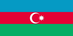
| Flag of Azerbaijan | |
The Azerbaijan Democratic Republic proclaimed its independence from the Transcaucasian Democratic Federative Republic in 1918 and became the first secular democratic Muslim-majority state. In 1920, the country was incorporated into the Soviet Union as the Azerbaijan SSR. The modern Republic of Azerbaijan proclaimed its independence on 30 August 1991, shortly before the dissolution of the Soviet Union in the same year. In September 1991, the ethnic Armenian majority of the Nagorno-Karabakh region formed the self-proclaimed Republic of Artsakh. The region and seven surrounding districts are internationally recognized as part of Azerbaijan pending a solution to the status of the Nagorno-Karabakh through negotiations facilitated by the OSCE, although became de facto independent with the end of the First Nagorno-Karabakh War in 1994. Following the Second Nagorno-Karabakh War in 2020, the seven districts and parts of Nagorno-Karabakh were returned to Azerbaijani control.
Currency / Language
| ISO | Currency | Symbol | Significant figures |
|---|---|---|---|
| AZN | Azerbaijani manat | ₼ | 2 |
| ISO | Language |
|---|---|
| HY | Armenian language |
| AZ | Azerbaijani language |
| RU | Russian language |


