Baharly District (Baharly District)
Baherden District is a district of Ahal Province, Turkmenistan. From 2003 to 2018 it was named Baharly ("spring-like") District.
It was formed in January 1926 as the Bakharden District of the Poltoratsk District of the Turkmen SSR. Its administrative center was Bakharden Station. In August 1926 the Poltoratsk District was abolished, and the Bakharden District was directly subordinated to the Turkmen SSR.
In November 1939, the region was assigned to the newly formed Ashkhabad oblast. In May 1959, Ashgabat oblast was abolished and the district again became a direct subordination of the Turkmen SSR. In 1963, the Bakharden District was abolished, but in 1965 it was reёstablished. In December 1973, Ashgabat oblast was recreated, which included the Bakharden district. In 1988, Ashgabat oblast was again abolished and the district was directly subordinated to the Turkmen SSR.
On 23 October 2003, by Presidential Decree 6435 the city and district (etrap) of Bäherden were renamed Baharly (“spring-like”). On 5 January 2018, by Parliamentary Resolution No. 686-V, Baharly city and district (etrap) had their old name of Bäherden restored.
Map - Baharly District (Baharly District)
Map
Country - Turkmenistan
 |
 |
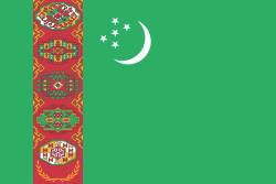
| Flag of Turkmenistan | |
Turkmenistan has long served as a thoroughfare for other nations and cultures. Merv is one of the oldest oasis-cities in Central Asia, and was once the biggest city in the world. It was also one of the great cities of the Islamic world and an important stop on the Silk Road. Annexed by the Russian Empire in 1881, Turkmenistan figured prominently in the anti-Bolshevik movement in Central Asia. In 1925, Turkmenistan became a constituent republic of the Soviet Union, the Turkmen Soviet Socialist Republic (Turkmen SSR); it became independent after the dissolution of the Soviet Union in 1991.
Currency / Language
| ISO | Currency | Symbol | Significant figures |
|---|---|---|---|
| TMT | Turkmenistan manat | m | 2 |
| ISO | Language |
|---|---|
| RU | Russian language |
| TK | Turkmen language |
| UZ | Uzbek language |


