Map - Gilgit-Baltistan

Gilgit-Baltistan
Gilgit-Baltistan, formerly known as the Northern Areas, is a region administered by Pakistan as an administrative territory, and constituting the northern portion of the larger Kashmir region which has been the subject of a dispute between India and Pakistan since 1947, and between India and China from somewhat later.The application of the term "administered" to the various regions of Kashmir and a mention of the Kashmir dispute is supported by the tertiary sources (a) through (d), reflecting due weight in the coverage. Although "controlled" and "held" are also applied neutrally to the names of the disputants or to the regions administered by them, as evidenced in sources (e) through (g) below, "held" is also considered politicized usage, as is the term "occupied," (see (h) below):

(a) (subscription required) Quote: "Kashmir, region of the northwestern Indian subcontinent ... has been the subject of dispute between India and Pakistan since the partition of the Indian subcontinent in 1947. The northern and western portions are administered by Pakistan and comprise three areas: Azad Kashmir, Gilgit, and Baltistan, the last two being part of a territory called the Northern Areas. Administered by India are the southern and southeastern portions, which constitute the state of Jammu and Kashmir but are slated to be split into two union territories."; (b) (subscription required) Quote: "Aksai Chin, Chinese (Pinyin) Aksayqin, portion of the Kashmir region, at the northernmost extent of the Indian subcontinent in south-central Asia. It constitutes nearly all the territory of the Chinese-administered sector of Kashmir that is claimed by India to be part of the Ladakh area of Jammu and Kashmir state."; (c) C. E Bosworth, University of Manchester Quote: "KASHMIR, kash'mer, the northernmost region of the Indian subcontinent, administered partlv by India, partly by Pakistan, and partly by China. The region has been the subject of a bitter dispute between India and Pakistan since they became independent in 1947"; (d) Quote: "We move from a disputed international border to a dotted line on the map that represents a military border not recognized in international law. The line of control separates the Indian and Pakistani administered areas of the former Princely State of Jammu and Kashmir."; (e) (subscription required) Quote: "... China became active in the eastern area of Kashmir in the 1950s and has controlled the northeastern part of Ladakh (the easternmost portion of the region) since 1962."; (f) Quote: "J&K: Jammu and Kashmir. The former princely state that is the subject of the Kashmir dispute. Besides IJK (Indian-controlled Jammu and Kashmir. The larger and more populous part of the former princely state. It has a population of slightly over 10 million, and comprises three regions: Kashmir Valley, Jammu, and Ladakh.) and AJK ('Azad" (Free) Jammu and Kashmir. The more populous part of Pakistani-controlled J&K, with a population of approximately 2.5 million. AJK has six districts: Muzaffarabad, Mirpur, Bagh, Kodi, Rawalakot, and Poonch. Its capital is the town of Muzaffarabad. AJK has its own institutions, but its political life is heavily controlled by Pakistani authorities, especially the military), it includes the sparsely populated "Northern Areas" of Gilgit and Baltistan, remote mountainous regions which are directly administered, unlike AJK, by the Pakistani central authorities, and some high-altitude uninhabitable tracts under Chinese control." (g) Quote: "Kashmir's identity remains hotly disputed with a UN-supervised "Line of Control" still separating Pakistani-held Azad ("Free") Kashmir from Indian-held Kashmir."; (h) Quote:"Some politicised terms also are used to describe parts of J&K. These terms include the words 'occupied' and 'held'." It borders Azad Kashmir to the south, the province of Khyber Pakhtunkhwa to the west, the Wakhan Corridor of Afghanistan to the north, the Xinjiang region of China, to the east and northeast, and the Indian-administered union territories Jammu and Kashmir and Ladakh to the southeast.

The region, together with Azad Kashmir in the southwest, is grouped and referred to by the United Nations and other international organisations as "Pakistan-administered Kashmir". Gilgit-Baltistan is six times larger than Azad Kashmir in terms of geographical area.

The territory of present-day Gilgit-Baltistan became a separate administrative unit in 1970 under the name "Northern Areas". It was formed by the amalgamation of the former Gilgit Agency, the Baltistan district, and several small former princely states, the largest of which were Hunza and Nagar. In 2009, the region was renamed to "Gilgit-Baltistan" and granted limited autonomy through the Self-Governance Order signed in by former Pakistani president Asif Ali Zardari, a move that was reportedly intended to also empower the territory's people; however, scholars state that the real power rests with the governor and not with the chief minister or elected assembly. Much of the population of Gilgit-Baltistan reportedly wants the territory to become integrated with Pakistan proper as a fifth province, and opposes integration with the rest of the Kashmir region. The Pakistani government had rejected calls from the territory for provincial status on the grounds that granting such a request would jeopardise Pakistan's demands for the entire Kashmir conflict to be resolved according to all related United Nations resolutions. However, in November 2020, Pakistani prime minister Imran Khan announced that Gilgit-Baltistan would attain provisional provincial status after the 2020 Gilgit-Baltistan Assembly election.

Gilgit-Baltistan covers an area of over 72,971 km2 (28,174 sq mi) and is highly mountainous. It had an estimated population of 1.249 million people in 2013 (estimated to be 1.8 million in 2015 . Its capital city is Gilgit (est. population 216,760). The region is home to five of the 14 eight-thousanders, including K2, and additionally has more than fifty mountain peaks above 7,000 metres (23,000 ft). Three of the world's longest glaciers outside of Earth's polar regions are found in Gilgit-Baltistan. The main tourism activities are trekking and mountaineering, and this industry has been growing in importance throughout the region.

The rock carvings found in various places in Gilgit-Baltistan, especially in the Passu village of Hunza, suggest a human presence since 2000 BC. Within the next few centuries of human settlement on the Tibetan plateau, this region became inhabited by Tibetans, who preceded the Balti people of Baltistan. Today Baltistan bears similarity to Ladakh physically and culturally (although not in religion). Dards are found mainly in the western areas. These people are the Shina-speaking peoples of Gilgit, Chilas, Astore and Diamir, while in Hunza and the upper regions, Burushaski and Khowar speakers predominate. The Dards find mention in the works of Herodotus, Nearchus, Megasthenes, Pliny, Ptolemy, and the geographical lists of the Puranas. In the 1st century, the people of these regions were followers of the Bon religion while in the 2nd century, they practiced Buddhism.

Between 399 and 414, the Chinese Buddhist pilgrim Faxian visited Gilgit-Baltistan. In the 6th century Somana Palola (greater Gilgit-Chilas) was ruled by an unknown king. Between 627 and 645, the Chinese Buddhist pilgrim Xuanzang travelled through this region on his pilgrimage to India.

According to Chinese records from the Tang dynasty, between the 600s and the 700s, the region was governed by a Buddhist dynasty referred to as Bolü, also transliterated as Palola, Patola, Balur. They are believed to have been the Patola Shahis dynasty mentioned in a Brahmi inscription, and devout adherents of Vajrayana Buddhism. At the time, Little Palola was used to refer to Gilgit, while Great Palola was used to refer to Baltistan. However, the records do not consistently disambiguate the two.

In mid-600s, Gilgit came under Chinese suzerainty after the fall of the Western Turkic Khaganate to Tang military campaigns in the region. In the late 600s CE, the rising Tibetan Empire wrestled control of the region from the Chinese. However, faced with growing influence of the Umayyad Caliphate and then the Abbasid Caliphate to the west, the Tibetans were forced to ally themselves with the Islamic caliphates. The region was then contested by Chinese and Tibetan forces, and their respective vassal states, until the mid-700s. Rulers of Gilgit formed an alliance with the Tang Chinese, and held back the Arabs with their help.

Between 644 and 655, Navasurendrāditya-nandin became king of the Palola Sāhi dynasty in Gilgit. Numerous Sanskrit inscriptions, including the Danyor Rock Inscriptions, were discovered to be from his reign. In the late 600s and early 700s, Jayamaṅgalavikramāditya-nandin was king of Gilgit. 
Map - Gilgit-Baltistan
Map
Google Earth - Map - Gilgit-Baltistan
Google Earth
Openstreetmap - Map - Gilgit-Baltistan
Openstreetmap
Map - Gilgit-Baltistan - Esri.WorldImagery
Esri.WorldImagery
Map - Gilgit-Baltistan - Esri.WorldStreetMap
Esri.WorldStreetMap
Map - Gilgit-Baltistan - OpenStreetMap.Mapnik
OpenStreetMap.Mapnik
Map - Gilgit-Baltistan - OpenStreetMap.HOT
OpenStreetMap.HOT
Map - Gilgit-Baltistan - CartoDB.Positron
CartoDB.Positron
Map - Gilgit-Baltistan - CartoDB.Voyager
CartoDB.Voyager
Map - Gilgit-Baltistan - OpenMapSurfer.Roads
OpenMapSurfer.Roads
Map - Gilgit-Baltistan - Esri.WorldTopoMap
Esri.WorldTopoMap
Map - Gilgit-Baltistan - Stamen.TonerLite
Stamen.TonerLite
Country - Pakistan
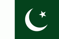
Flag of Pakistan
Pakistan, officially the Islamic Republic of Pakistan , is a country in South Asia. It is the world's fifth-most populous country, with a population of almost 243 million people, and has the world's second-largest Muslim population just behind Indonesia. Pakistan is the 33rd-largest country in the world by area and 2nd largest in South Asia, spanning 881,913 km2. It has a 1,046 km coastline along the Arabian Sea and Gulf of Oman in the south, and is bordered by India to the east, Afghanistan to the west, Iran to the southwest, and China to the northeast. It is separated narrowly from Tajikistan by Afghanistan's Wakhan Corridor in the north, and also shares a maritime border with Oman. Islamabad is the nation's capital, while Karachi is its largest city and financial centre.

Pakistan is the site of several ancient cultures, including the 8,500-year-old Neolithic site of Mehrgarh in Balochistan, the Indus Valley civilisation of the Bronze Age, the most extensive of the civilisations of the Afro-Eurasia, and the ancient Gandhara civilization. The region that comprises the modern state of Pakistan was the realm of multiple empires and dynasties, including the Achaemenid; briefly that of Alexander the Great; the Seleucid, the Maurya, the Kushan, the Gupta; the Umayyad Caliphate in its southern regions, the Hindu Shahis, the Ghaznavids, the Delhi Sultanate, the Mughals, the Durranis, the Omani Empire, the Sikh Empire, British East India Company rule, and most recently, the British Indian Empire from 1858 to 1947.
Currency / Language  
ISO Currency Symbol Significant figures
PKR Pakistani rupee ₨ 2
Neighbourhood - Country  
  •  Afghanistan 
  •  China 
  •  India 
  •  Iran 
Administrative Subdivision
Country, State, Region,...
City, Village,...
Airport