Agaro (Āgaro)
Agaro (or Haggaro) (Aggaaroo) is a town and separate woreda in south-western Ethiopia. Located in the Jimma Zone of the Oromia Region, it sits at a latitude and longitude of 7.85°N, 36.58333°W, and an elevation of 1560 meters above sea level.
The road that originally connected Agaro to Jimma was "better known for its depth than for its length" until improvements were completed in 1962. The road to Bedele, 96 km long, was completed in 1968 at a cost of 12 million dollars (Ethiopian), by the French company Razel Frères. Agaro is one of the most important trading centers of coffee in Ethiopia. The Jimma Institute of Public Health (part of Jimma University) operates a teaching center for health care in Agaro.
Agaro was the capital of the former Kingdom of Gomma, until Gomma was conquered by Dejazmach Besha Abuye in 1886. By 1958, the settlement was one of 27 places in Ethiopia ranked as a First Class Township. Fitawrari Gebre Kristos, started coffee plantations in the 1950s on land he inherited from his grandfather Fitawrari Wossen. Fitawrari Besha could employ up to 400 workers during high harvest season. After the Ethiopian revolution, Gebre Kristos abandoned his plantation and retired to Addis Ababa; his plantation was nationalized by the Land Nationalization Proclamation of March 1975.
In term of school and education the town have some elementary, senior, secondary and preparatory schools. Agaro secondary and preparatory school is one of the oldest secondary and preparatory school in the town.
Map - Agaro (Āgaro)
Map
Country - Ethiopia
 |
 |
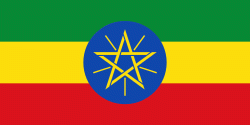
| Flag of Ethiopia | |
Anatomically modern humans emerged from modern-day Ethiopia and set out to the Near East and elsewhere in the Middle Paleolithic period. Southwestern Ethiopia has been proposed as a possible homeland of the Afroasiatic language family. In 980 BCE, the Kingdom of D'mt extended its realm over Eritrea and the northern region of Ethiopia, while the Kingdom of Aksum maintained a unified civilization in the region for 900 years. Christianity was embraced by the kingdom in 330, and Islam arrived by the first Hijra in 615. After the collapse of Aksum in 960, a variety of kingdoms, largely tribal confederations, existed in the land of Ethiopia. The Zagwe dynasty ruled the north-central parts until being overthrown by Yekuno Amlak in 1270, inaugurating the Ethiopian Empire and the Solomonic dynasty, claimed descent from the biblical Solomon and Queen of Sheba under their son Menelik I. By the 14th century, the empire grew in prestige through territorial expansion and fighting against adjacent territories; most notably, the Ethiopian–Adal War (1529–1543) contributed to fragmentation of the empire, which ultimately fell under a decentralization known as Zemene Mesafint in the mid-18th century. Emperor Tewodros II ended Zemene Mesafint at the beginning of his reign in 1855, marking the reunification and modernization of Ethiopia.
Currency / Language
| ISO | Currency | Symbol | Significant figures |
|---|---|---|---|
| ETB | Ethiopian birr | Br | 2 |
| ISO | Language |
|---|---|
| AM | Amharic language |
| EN | English language |
| OM | Oromo language |
| SO | Somali language |
| TI | Tigrinya language |


