Harar
 |
 |
Harar is the capital city of the Harari Region. The ancient city is located on a hilltop in the eastern part of the country and is about five hundred kilometers from the Ethiopian capital Addis Ababa at an elevation of 1885 m.
For centuries, Harar has been a major commercial center, linked by the trade routes with the rest of Ethiopia, the entire Horn of Africa, the Arabian Peninsula, Asia, and through its ports, the outside world. Harar Jugol, the old walled city, was listed as a World Heritage Site in 2006 by UNESCO in recognition of its cultural heritage. Because of Harar's long history of involvement during times of trade in the Arabian Peninsula, the Government of Ethiopia has made it a criminal offence to demolish or interfere with any historical sites or fixtures in the city. These include stone homes, museums and items discarded from war. According to UNESCO, it is "considered 'the fourth holiest city' of Islam" with 82 mosques, three of which date from the 10th century, and 102 shrines.
Yahyá Naṣrallāh's Fatḥ Madīnat Harar, an unpublished history of the city in the 13th century, records that the legendary saint Abadir Umar ar-Rida and several other religious leaders settled in the Harar plateau c. 1216 (612 AH). Harar was later made the new capital of the Adal Sultanate in 1520 by the Sultan Abu Bakr ibn Muhammad. The city saw a political decline during the ensuing Emirate of Harar, only regaining some significance in the Khedivate of Egypt period. During the Ethiopian Empire, the city decayed while maintaining a certain cultural prestige.
When Harar was founded is unclear and various dates have been suggested. In any case, the modern city of Harar mostly dates back to the 1700s at the earliest, but the site itself has been the site of a city for much longer.
It is likely the original inhabitants of the region are the Harari people. Harar was part of the Harla Kingdom's domain in the sixth century. In the Islamic period, the city was under an alliance of confederated states of Zeila. According to the twelfth-century Jewish traveler Benjamin of Tudela, the Zeila region was the land of the Havilah, confined by al-Habash in the west.
In the ninth century, Harar was under the Maḥzūmī dynasty's Sultanate of Shewa.
Islam had gained a foothold on the Harar plateau by the 10th-11th centuries CE via trade with Zeila. By the 13th century Islam had become the predominant religion in the region.
Map - Harar
Map
Country - Ethiopia
 |
 |
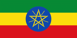
| Flag of Ethiopia | |
Anatomically modern humans emerged from modern-day Ethiopia and set out to the Near East and elsewhere in the Middle Paleolithic period. Southwestern Ethiopia has been proposed as a possible homeland of the Afroasiatic language family. In 980 BCE, the Kingdom of D'mt extended its realm over Eritrea and the northern region of Ethiopia, while the Kingdom of Aksum maintained a unified civilization in the region for 900 years. Christianity was embraced by the kingdom in 330, and Islam arrived by the first Hijra in 615. After the collapse of Aksum in 960, a variety of kingdoms, largely tribal confederations, existed in the land of Ethiopia. The Zagwe dynasty ruled the north-central parts until being overthrown by Yekuno Amlak in 1270, inaugurating the Ethiopian Empire and the Solomonic dynasty, claimed descent from the biblical Solomon and Queen of Sheba under their son Menelik I. By the 14th century, the empire grew in prestige through territorial expansion and fighting against adjacent territories; most notably, the Ethiopian–Adal War (1529–1543) contributed to fragmentation of the empire, which ultimately fell under a decentralization known as Zemene Mesafint in the mid-18th century. Emperor Tewodros II ended Zemene Mesafint at the beginning of his reign in 1855, marking the reunification and modernization of Ethiopia.
Currency / Language
| ISO | Currency | Symbol | Significant figures |
|---|---|---|---|
| ETB | Ethiopian birr | Br | 2 |
| ISO | Language |
|---|---|
| AM | Amharic language |
| EN | English language |
| OM | Oromo language |
| SO | Somali language |
| TI | Tigrinya language |


