Rotuma
Rotuma is a Fijian dependency, consisting of Rotuma Island and nearby islets. The island group is home to a large and unique Polynesian indigenous ethnic group which constitutes a recognisable minority within the population of Fiji, known as "Rotumans". Its population at the 2017 census was 1,594, although many more Rotumans live on mainland Fijian islands, totaling 10,000.
The Rotuma group of volcanic islands are located 646 km (Suva to Ahau) north of Fiji. Rotuma Island itself is 13 km long and 4 km wide, with a land area of approximately 47 km2, making it the 12th-largest of the Fiji islands. The island is bisected by an isthmus into a larger eastern part and a western peninsula. The isthmus is low and narrow, only 230 m wide, and is the site of Motusa village (Itutiu district). North of the isthmus is Maka Bay, and in the south is Hapmafau Bay. There is a large population of coral reefs in these bays, and there are boat passages through them.
Rotuma is a shield volcano made of alkali-olivine basalt and hawaiite, with many small cones. It reaches 256 m above sea level at Mount Suelhof, near the center of the island. Satarua Peak, 166 m high, lies near the eastern end of the island. While they are very secluded from much of Fiji proper, the large reef and untouched beaches are renowned as some of the most beautiful in the Kingdom of Fiji.
There are several islands that lie between 50 m and 2 km distant from the main island, but are still within the fringing reef. They are:
* Solnohu (south)
* Solkope and Sari'i (southeast)
* Afgaha and Husia Rua (far southeast)
* Husia (Husiatiu) and Husiameamea (close southeast)
* Hạuameamea and Hạua (Hạuatiu) (close together northeast).
There is also a separate chain of islands that lie between 3 km and 6 km to the northwest and west of Rotuma Island. In order, from northeast to southwest, these are:
Map - Rotuma
Map
Country - Fiji
 |
 |
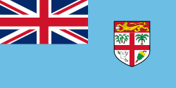
| Flag of Fiji | |
The majority of Fiji's islands were formed by volcanic activity starting around 150 million years ago. Some geothermal activity still occurs today on the islands of Vanua Levu and Taveuni. The geothermal systems on Viti Levu are non-volcanic in origin and have low-temperature surface discharges (of between roughly 35 and 60 C).
Currency / Language
| ISO | Currency | Symbol | Significant figures |
|---|---|---|---|
| FJD | Fijian dollar | $ | 2 |
| ISO | Language |
|---|---|
| EN | English language |
| FJ | Fijian language |


