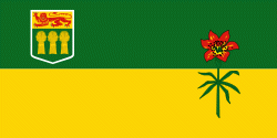
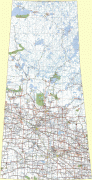
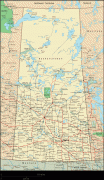
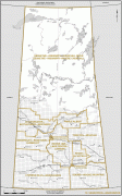
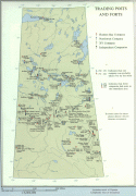
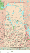
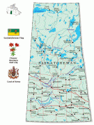
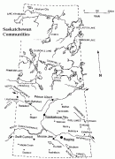
Saskatchewan
 |
 |
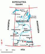
Residents primarily live in the southern prairie half of the province, while the northern half is mostly forested and sparsely populated. Roughly half live in the province's largest city Saskatoon or the provincial capital Regina. Other notable cities include Prince Albert, Moose Jaw, Yorkton, Swift Current, North Battleford, Melfort, and the border city Lloydminster. English is the primary language of the province, with 82.4% of Saskatchewanians speaking English as their first language.
Saskatchewan has been inhabited for thousands of years by indigenous groups. Europeans first explored the area in 1690 and first settled in the area in 1774. It became a province in 1905, carved out from the vast North-West Territories, which had until then included most of the Canadian Prairies. In the early 20th century, the province became known as a stronghold for Canadian social democracy; North America's first social-democratic government was elected in 1944. The province's economy is based on agriculture, mining, and energy.
Saskatchewan is presently governed by premier Scott Moe, a member of the Saskatchewan Party which has been in power since 2007.
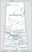
In 1992, the federal and provincial governments signed a historic land claim agreement with First Nations in Saskatchewan. The First Nations received compensation which they could use to buy land on the open market for the bands. They have acquired about 3079 km2, new reserve lands under this process. Some First Nations have used their settlement to invest in urban areas, including Regina and Saskatoon.
The name of the province is derived from the Saskatchewan River. The river is known as ᑭᓯᐢᑳᒋᐘᓂ ᓰᐱᐩ kisiskāciwani-sīpiy ("swift flowing river") in the Cree language. Henday's spelling was Keiskatchewan, with the modern rendering, Saskatchewan, being officially adopted in 1882 when a portion of the present-day province was designated a provisional district of the North-West Territories.
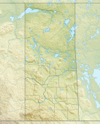
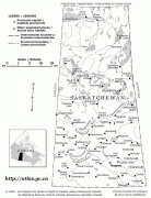
Map - Saskatchewan
Map


Country - Canada
 |
 |
| Flag of Canada | |
Indigenous peoples have continuously inhabited what is now Canada for thousands of years. Beginning in the 16th century, British and French expeditions explored and later settled along the Atlantic coast. As a consequence of various armed conflicts, France ceded nearly all of its colonies in North America in 1763. In 1867, with the union of three British North American colonies through Confederation, Canada was formed as a federal dominion of four provinces. This began an accretion of provinces and territories and a process of increasing autonomy from the United Kingdom. This widening autonomy was highlighted by the Statute of Westminster 1931 and culminated in the Canada Act 1982, which severed the vestiges of legal dependence on the Parliament of the United Kingdom.
Currency / Language
| ISO | Currency | Symbol | Significant figures |
|---|---|---|---|
| CAD | Canadian dollar | $ | 2 |
| ISO | Language |
|---|---|
| EN | English language |
| FR | French language |
| IU | Inuktitut |


